
Cooper Island and Salt Island, BVI: A Crewed Charter Guide
Cooper Island’s rum bar pours over 400 rums near Cistern Point’s reef, and the 1867 RMS Rhone wreck lies off Salt Island next door. Plan both on a BVI charter.
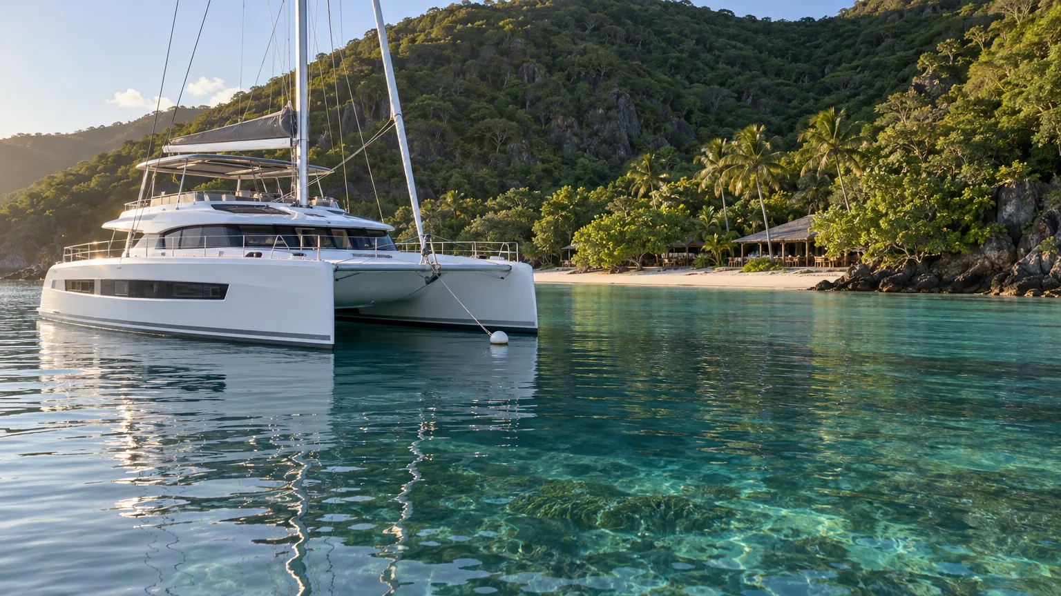
Cooper Island is a largely private island about 5 miles off Tortola’s southeastern shore, home to “a handful of private residences, as well as a beachfront resort” (BVI Tourism, 2026). That resort, Cooper Island Beach Club, sits on Manchioneel Bay, where a crewed yacht picks up a mooring for the night. Salt Island, the next island west, has no resort, just two salt ponds, an empty settlement and, off its western shore, the wreck of the RMS Rhone.
The beach club calls Manchioneel Bay “a natural stop along the Sister Island chain leading to The Baths” (Cooper Island Beach Club, 2026). On a crewed BVI charter, that chain is the run east from Norman Island toward Virgin Gorda. Neither island has a public ferry, so both are stops for yachts cruising the British Virgin Islands.
Where are Cooper Island and Salt Island?
Cooper Island and Salt Island are two of the “Little Sisters,” the small islands south of Tortola and southwest of Virgin Gorda (Wikipedia, 2024). Salt lies “about 4.7 miles south east” of Road Town (Wikipedia, 2026), between Cooper Island to its east and Peter Island and Dead Chest to its west (Virgin Islands News Online, 2024). Beyond Peter, Norman Island and its Bight closes the chain at the western end.
Cooper had 26 residents at the 2010 census (Wikipedia, 2026), and nobody lives on Salt year-round anymore. Day visitors from Tortola come over by water taxi or day boat. A yacht moves between the two inside the Sir Francis Drake Channel, with Tortola standing between them and the Atlantic.
| Compare | Cooper Island | Salt Island |
|---|---|---|
| Where | Off Tortola’s southeast shore, east of Salt | Southeast of Road Town, west of Cooper |
| Ashore | Beach club, restaurant, bars, coffee shop, brewery, boutique | Salt ponds, empty settlement, Rhone grave |
| In the water | Cistern Point, turtles in Manchioneel Bay | The RMS Rhone in Lee Bay |
| Stay the night? | Yes, on a mooring in Manchioneel Bay | No, a day stop |
Sources: BVI Tourism, Wikipedia, BVI National Parks Trust, Cooper Island Beach Club, 2024-2026.
Manchioneel Bay: where yachts spend the night
Manchioneel Bay, on Cooper Island’s northwest shore, is the island’s mooring field and one of the Department of Conservation and Fisheries’ seagrass monitoring sites (Cooper Island Beach Club, 2026). That seagrass is why yachts here lie on mooring balls rather than anchoring.
The seagrass also feeds the bay’s turtles: a SAIL writer arriving by yacht was greeted by “one medium-sized and one very large sea turtle” (SAIL, 2015). Under the boats it’s a “deep, somewhat grassy bay” sprinkled with mooring balls (Online Cruising Guide, 2021).
In season the balls “tend to be full by 12 noon” (Cooper Island Beach Club, 2026), so a night at Cooper often starts with lunch ashore. The biggest yachts don’t fit the field at all: they spend the night just outside it or at a nearby anchorage, and you ride the tender in for dinner.
See which crewed yachts cruise Cooper, Salt and the rest of the BVI for a group your size.
What does Cooper Island Beach Club have today?
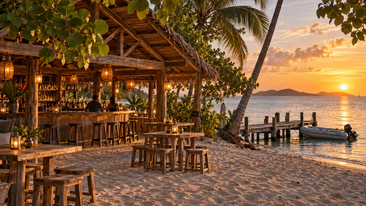
Cooper Island Beach Club runs a beachfront restaurant, a main bar, a coffee shop, an on-site microbrewery, a boutique and eight beachfront rooms on the island’s northwest shore. Its rum bar stocks “over 400 rums from all over the world” (Cooper Island Beach Club, 2026).
The Harris family has owned the club since January 2009. The resort runs off-grid on solar power and calls itself “self sufficient in power and water” (Cooper Island Beach Club, 2026). By the club’s 2024 count, more than 300 solar panels make all its electricity and water, and its wastewater is treated to a standard clean enough for irrigation and washing down boats (Cooper Island Beach Club, 2024).
| At the beach club | What you’ll find | Good to know |
|---|---|---|
| Restaurant | Lunch and dinner, local seafood, Josper-grilled mains | Dinner is booked ahead |
| Rum Bar | Sipping rums, rum flights, house infusions | The sunset spot |
| Main bar | Painkillers, rum punch, Dark & Stormys | Happy hour 3pm to 5pm |
| Coffee Box | Organic VI Coffee Roasters coffee, pastries, gelato | Free Wi-Fi, at the northern dinghy dock |
| Microbrewery | Lager, pilsner and Turtle IPA brewed on site | A beer flight tries them all |
| SeaGrape Boutique | Resortwear, swimwear, reef-safe sunscreen | Next to the Coffee Box |
Source: Cooper Island Beach Club website and 2026-27 menus.
The club calls its brewery the British Virgin Islands’ “only solar-powered microbrewery” (Cooper Island Beach Club, 2026), and it has poured its own beer since March 2016. The Turtle IPA came along in 2017, and the club gives $1 from every one sold to sea turtle conservation (Cooper Island Beach Club, 2025).
Yacht guests have the public side of the resort (the bars, coffee shop, boutique, restaurant and beaches), and the club asks them to leave the hotel side to its overnight guests. Most of the island is privately owned. “There are no hiking trails or guided hikes on Cooper Island,” the club says (Cooper Island Beach Club, 2026).
Dinner and dress code
Cooper Island Beach Club takes dinner reservations up to 10 days ahead and holds a table for 15 minutes before canceling it (Cooper Island Beach Club, 2026), so the crew books early and has you ashore with time to spare. “Shirts, shoes & cover-ups are required at dinner” (Cooper Island Beach Club, 2026). On the 2026-27 menus the fish of the day is $38 at dinner and the beef burger $30 at lunch, with an 18% service charge added to every bill (Cooper Island Beach Club, 2026).
The closed season
Cooper Island Beach Club closes every year for the late-summer season. Its own season notices show it shutting in early August and reopening around the start of November in 2024, 2025 and 2026. The hotel rooms are closed from 25 July to 7 November 2026 (Cooper Island Beach Club, 2026).
Where is the snorkeling at Cooper Island?
Cooper Island’s best-known snorkeling site is Cistern Point, “West of Manchioneel Bay (Francis Drake Channel side)” (The VI Magazine, 2014), where the BVI National Parks Trust keeps a day-use dive and snorkel mooring (BVI National Parks Trust, 2012). SAIL suggests tying the dinghy, kayak or paddleboard “to the string line near Cistern Point” (SAIL, 2017), an easy hop from a yacht in the bay.
SAIL lists parrotfish and grunts, schools of blue tang, plenty of sea stars and, “if you’re lucky,” a ray. Cistern Point sits inside the Sir Francis Drake Channel, sheltered by Tortola from the Atlantic swell. So do the Caves at Norman Island and the Rhone next door, two more of the best snorkeling spots in the BVI.
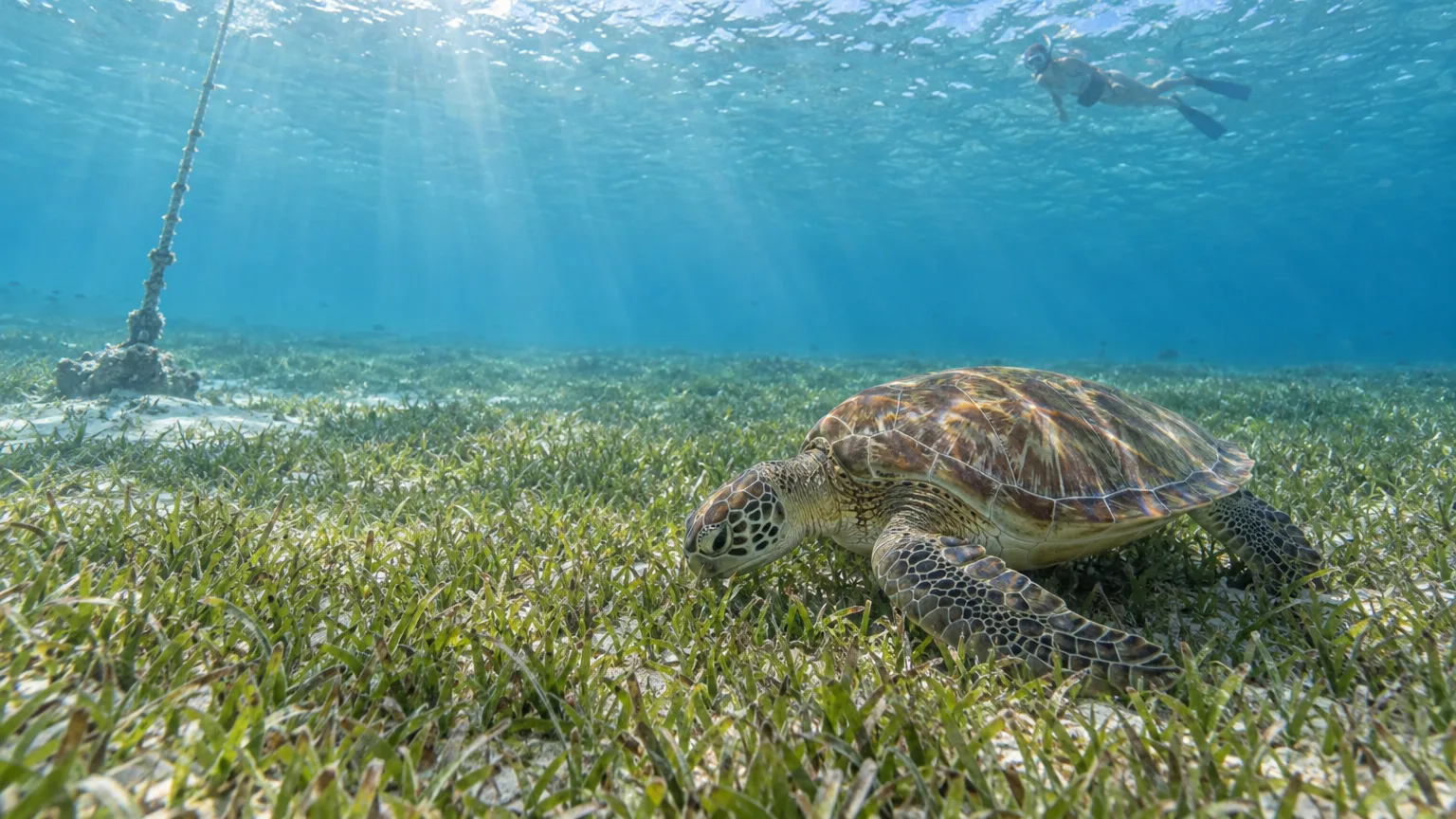
Snorkelers who stay in the bay still have the turtles among the moorings, and in front of the resort Hurricane Irma left “a submerged dock” that is “now the home to lots of sea life” (Cooper Island Beach Club, 2024). The club’s boutique sells reef-safe sunscreen if you’ve run short.
At this end of the channel, scuba diving in the BVI includes Wreck Alley, where several vessels off Cooper “have been deliberately sunk as dive sites” (Wikipedia, 2026).
What can you see ashore on Salt Island?
Salt Island has three things to see ashore: the salt ponds that gave the island its name, the old settlement beside them, and the mass grave where islanders buried the Rhone‘s dead (Virgin Islands News Online, 2024).
The salt ponds
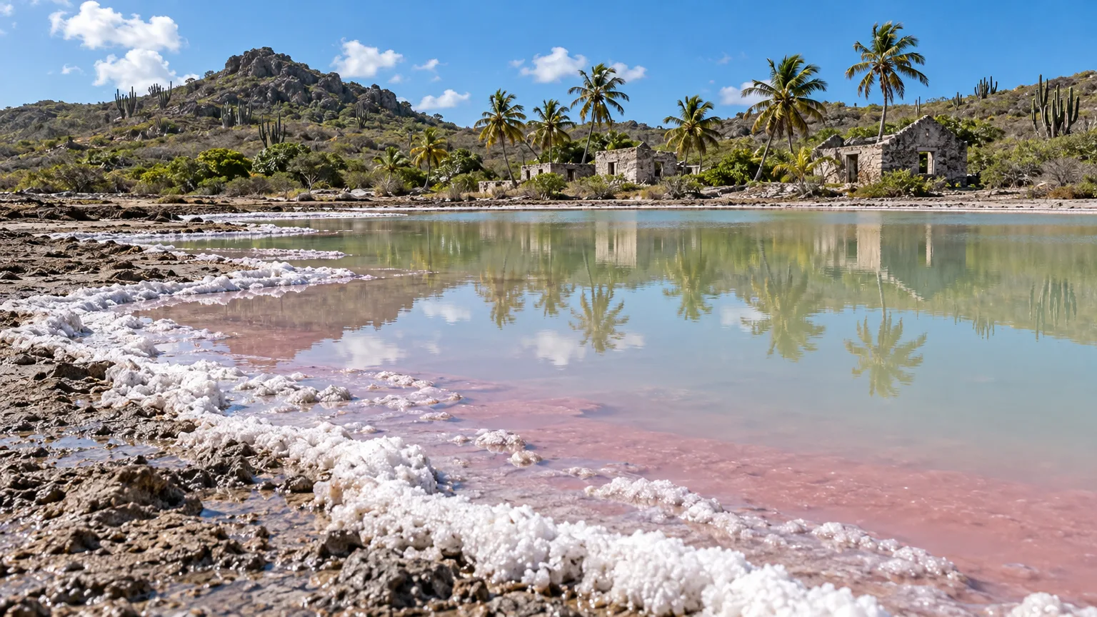
Salt Island’s main salt pond is one of the two saltiest of 17 British Virgin Islands ponds in a peer-reviewed study. It gets “small but constant seawater input through underground seeps,” and salt crystallizes over its bottom in dry spells (Jarecki and Walkey, Saline Systems, 2006). The pond measured 4.0 hectares, about 10 acres.
One descendant of the island writes that it has two ponds, joined by seepage and a canal, covering about 12 acres together (Virgin Islands News Online, 2021). The ponds are “just a short walk from the beach” (The VI Magazine, 2021). Expect a beach landing by tender: the island’s dock was destroyed by Hurricane Irma in 2017 and still hadn’t been repaired in September 2021 (Virgin Islands News Online, 2021).
The salt was once a government affair. In the late 1800s islanders waited for the official firing of a pistol before the “salt breaking” began, and under the 1904 Government Salt Pond Ordinance the government kept one bag in every three (The VI Magazine, 2021). The same piece says that with the weather changing, the salt now forms in the summer months, and descendants still pick it on a small scale.
The best-known story is that islanders sent the monarch a pound of salt each year as rent. That’s oral history rather than a written law. When the tradition was revived for Queen Elizabeth II’s 90th birthday in March 2016, the Premier said he had searched for stories of the salt gift “but I couldn’t” find them (Virgin Islands News Online, 2016). That 2016 ceremony was the last official one (The VI Magazine, 2021).
The settlement
The settlement sits on a strip of land between the main pond and Salt Island Bay. The island “has not been known to have more than 100 inhabitants at a time” (The VI Magazine, 2021), and a minister told BVI News it never had a church or power (BVI News, 2019). The last permanent residents had gone by the late 2000s (The VI Magazine, 2021).
The government is distributing the island’s Crown land among descendants of five families (Leonard, Smith, Abbott, Thomas and Durante). A master plan for the island is to take in the salt ponds and the burial grounds (Virgin Islands News Online, 2022). Descendants come back every year around Territory Day, and many still use their family plots as burial grounds (BVI News, 2019).
The Rhone grave
When the Rhone sank, islanders buried the bodies that washed ashore in a mass grave at the western end of the island (Virgin Islands News Online, 2024). As far back as 1990 the Executive Council advised preserving “the Salt Pond and the ‘Rhone’ cemetery” (Virgin Islands News Online, 2022). In June 2024 the National Parks Trust co-hosted a wreath-laying at the site, attended by women who grew up on the island.
The RMS Rhone off Salt Island
The RMS Rhone sank off Salt Island in a hurricane on 29 October 1867 (Wikipedia, 2026), and “only 23 of the 146 crew and passengers survived” (Virgin Islands News Online, 2024). The wreck lies in Lee Bay “in approximately 20 to 80 feet of water,” with its bow, boilers, engines and propeller still visible (BVI National Parks Trust, 2026).
The wreck sits inside the Wreck of the Rhone Marine Park, set up in 1980 and covering 800 acres including Dead Chest Island (BVI National Parks Trust, 2026). The Rhone is a day stop: yachts tie up to the park’s moorings, which are for day use only (BVI National Parks Trust, 2026). The ship’s anchor lies separately in 55 feet at Great Harbour on Peter Island (BVI National Parks Trust, 2026).
Snorkelers get the stern. SAIL found it “easy to snorkel from the propeller wedged in the shallows to the bow buried in 60ft of water” (SAIL, 2017). It’s open water with no beach, which suits confident swimmers. The wreck is also “the most popular dive site in the BVI” (BVI National Parks Trust, 2026), so the crew aims to be on a mooring first thing. Park mooring sites are “usually located in exposed areas, surrounded by rocks and reefs” (BVI National Parks Trust, 2012), so when a swell is running the crew leaves the wreck for a calmer morning.
Whatever you see on the wreck, leave it: historic shipwrecks in a BVI park are “strictly protected and no taking shall be allowed” (National Parks Act 2006, s.52).
How do Cooper and Salt fit into a BVI charter week?
Salt and Cooper fit into a single day, because Salt is the next island west of Cooper: the Rhone and the salt ponds take the morning, and Cooper takes the afternoon and the night. On the run east toward The Baths on Virgin Gorda, the pair sits between Peter Island and Virgin Gorda.
| Time | Where | What you do |
|---|---|---|
| Early morning | Lee Bay, Salt Island | Snorkel the Rhone‘s stern before the day boats |
| Mid-morning | Salt Island | Tender to the beach, walk to the ponds and the settlement |
| Midday | Manchioneel Bay, Cooper Island | Pick up a mooring, lunch at the beach club |
| Afternoon | Cistern Point | Snorkel off the dinghy line, or dive Wreck Alley |
| Late afternoon | Beach club | Happy hour, a beer flight or a rum tasting |
| Evening | Beach club | Dinner ashore, then the night on the mooring |
Built from Cooper Island Beach Club hours and the BVI National Parks Trust mooring rules, 2026.
In a seven-day BVI itinerary, Cooper is the second night, after Norman Island, and Salt fits in on the same day. The Vital Charters yacht search lists crewed yachts that cruise the BVI by group size.
Frequently Asked Questions
Is Cooper Island Beach Club open year-round?
No. In 2026 the restaurant and bars’ last day of service was 2 August, and their first scheduled day back was 1 November, according to the club’s season notice. The hotel rooms keep their own, longer closure. Outside those weeks the restaurant, the bars and the coffee shop are open to visiting yachts.
Can you snorkel at Cooper Island?
Yes. Besides Cistern Point, the BVI National Parks Trust’s mooring map marks Markoe Point and Thumb Rock among its day-use sites around Cooper, so the crew can choose the side with the calmest water. You can also snorkel straight off the yacht in Manchioneel Bay, where turtles graze under the boats.
Do you need a reservation for dinner at Cooper Island Beach Club?
Yes. Dinner at the beach club is by reservation, with seatings from 5:30pm to 8pm on the club’s booking page. Lunch has seatings too, from 11:30am to 2pm.
Is the RMS Rhone at Cooper Island?
No. The Rhone, a 310-foot Royal Mail steamer, lies in two main parts off Salt Island, the next island west of Cooper, according to the BVI National Parks Trust. Cooper’s own wrecks are in Wreck Alley, a separate dive site.
Can you visit Salt Island?
Yes, by tender from your yacht. The settlement and the main pond sit just behind Salt Island Bay, the island’s old harbor, while the Rhone lies around on the west side in Lee Bay. Nobody lives on the island year-round, so there’s nothing to buy ashore.
Is salt still harvested on Salt Island?
On a small scale, yes. In 2021 one descendant, Alexandra Durante, was using Salt Island salt in products sold at her store, E.Co, according to The VI Magazine. The old salt breaking that opened the harvest was held around Easter.
Can you stay overnight at Cooper Island?
Yes. On a crewed charter you sleep aboard, on a mooring in Manchioneel Bay. The beach club also has its own hotel rooms. The club says they’re fan-cooled rather than air-conditioned, with screened doors and windows, and pairs of rooms connect to make a two-bedroom suite.
The Rhone by morning, dinner on Cooper by night.
Tell us your group size and your dates, and we’ll match you with a crewed BVI yacht and a week that takes in Salt Island, Cooper and the rest of the chain.