
Pinel Island: Best of St. Martin
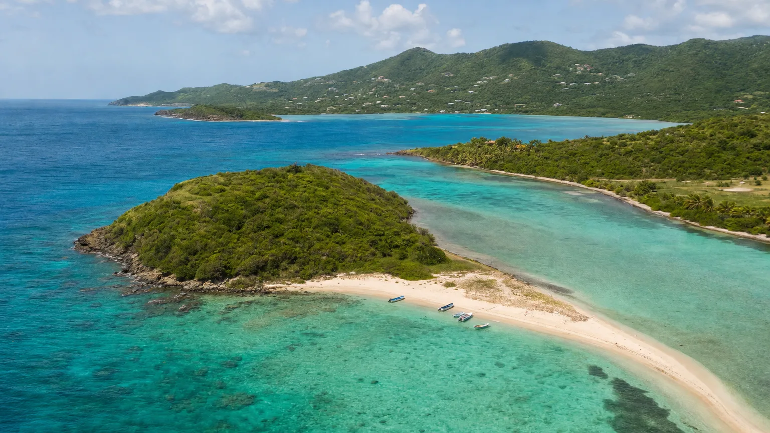
Pinel Island is an uninhabited islet off St. Martin’s northeast coast, inside a national nature reserve. Its draw is a marked underwater snorkel trail in under five metres of water, plus four beaches, a 1.5 km walking path, and an island that empties completely at half past four.
Last Updated: September 7, 2026
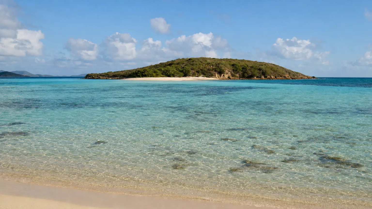
Pinel Island, Îlet Pinel in French, is a small uninhabited islet a few hundred metres off the northeast coast of St. Martin, opposite the bay of Cul-de-Sac, and it holds something no other stop in these islands has: a marked underwater trail you swim rather than walk. The water over it is two to three metres deep. You can stand up in most of it. And at half past four every afternoon, when the last boat leaves, the whole island empties and goes back to being deserted.
Where Is Pinel Island?
Pinel Island lies on the Atlantic side of St. Martin, directly opposite Cul-de-Sac bay, with a main hill topping out at around thirty metres above the sea (Réserve Naturelle Nationale de Saint-Martin, 2009). The reserve’s monitoring station on the islet’s snorkel trail sits at 18°06′N, 63°01′W, roughly 700 m off the coast (AGRNSM, 2017).
A geographic clarification first, because the search traffic suggests real confusion: Pinel is on the French side. St. Martin and St. Maarten are one island split between France and the Netherlands, and Cul-de-Sac, the bay Pinel faces, is French territory. You’ll see the islet written as “Pinel Island SXM,” borrowing the airport code that covers the whole island, but the islet itself sits in the French half. Our St. Martin and St. Barts charter destinations page maps how the two sides fit together.
The islet is named directly in the founding decree of the Réserve Naturelle Nationale de Saint-Martin, created on 3 September 1998 (Décret n°98-802). That decree does more work than it sounds like. Everything on and around Pinel is inside a national nature reserve, with one deliberate exception, the beach reception area, which the decree carves out by name so visitors can be landed and fed there.
The reserve is overwhelmingly marine: roughly 3,000 hectares in total, about 95% of it water (AGRNSM, 2017). Réserves Naturelles de France puts the marine area at 2,900 hectares against 154 hectares of land, plus 198 hectares of wetlands and 11 km of coastline (Réserves Naturelles de France). The two accounts differ slightly in how they divide the non-marine share. Pinel is classified alongside Caye Verte, Green Cay, plus Petite Clef, Tintamarre and the islets of Baie de l’Embouchure.
How Do You Get to Pinel Island?
By boat, and only by boat: the crossing from Cul-de-Sac takes five to ten minutes (RNNSM, 2009). There is no bridge, no causeway and no way to wade it.
The approach itself is the constraint. The reserve describes it as delicate, and it has to be made through the channel between Green Cay and Pinel (RNNSM). The water across the anchorage and trail area is charted at the one, one-and-a-half, two and five metre contours, genuinely shallow, which is what makes the snorkeling good and the navigation fussy.
Guests arriving on a crewed Caribbean charter come ashore by tender. Anchoring is permitted only on bare sand and never on the protected seagrass, so larger yachts lie off and run guests in rather than parking on top of the trail.
What Is the Pinel Island Snorkel Trail?
The reserve installed a public sentier sous-marin (an underwater trail) at Pinel in 2009, and the originality of the project won Saint-Martin’s Collectivité the 2011 IFRECOR Palme, France’s coral-reef initiative award, presented on 15 December 2011 (RNNSM Journal 14, 2011). This is the single best reason to put Pinel on a St. Martin itinerary, and most visitors never find out it exists.
Here’s what it actually is. The route runs along the southern and southwestern point of the islet, covering about 400 m of shoreline and roughly 5,000 m² of seabed. In that short distance it crosses sand, bare rock, seagrass beds, algal beds, coral reef and a small cave, six distinct habitats you can swim between in an afternoon (RNNSM, 2009).
How Deep Is the Snorkel Trail?
The whole site sits in under five metres of water, with the mapped segments annotated at two and three metres (RNNSM, 2009). The reserve chose the location deliberately: sheltered from currents and the prevailing wind, and positioned away from fire coral, from reef too shallow to swim over safely, from sharks, and from boat traffic. There are two routes, a beginner circuit and a longer one for confident swimmers, and the beginner route turns around at the cave.
One detail says a lot about the design. Station buoys were specified to sit in more than three metres of water (deliberately, so snorkelers can’t stand on the bottom and damage it) and to carry a handle or rail you can hold on to and rest (RNNSM, 2009). The interpretive stations were built around four themes: sand, seagrass, reef and gorgonians, and the cave.
The reserve currently presents the trail as a guided “ecosnorkeling” activity starting from the beach, led by a guide who is also a marine biologist, with equipment available and no scuba tanks involved (RNNSM). One honest caveat: the buoy-and-rope marking described above comes from the reserve’s 2009 design document, and we couldn’t confirm from a current source that the layout on the water is unchanged. Treat it as an established, reserve-run marked route rather than a guarantee of a specific set of floats on the day you arrive.
What Will You See Snorkeling at Pinel Island?
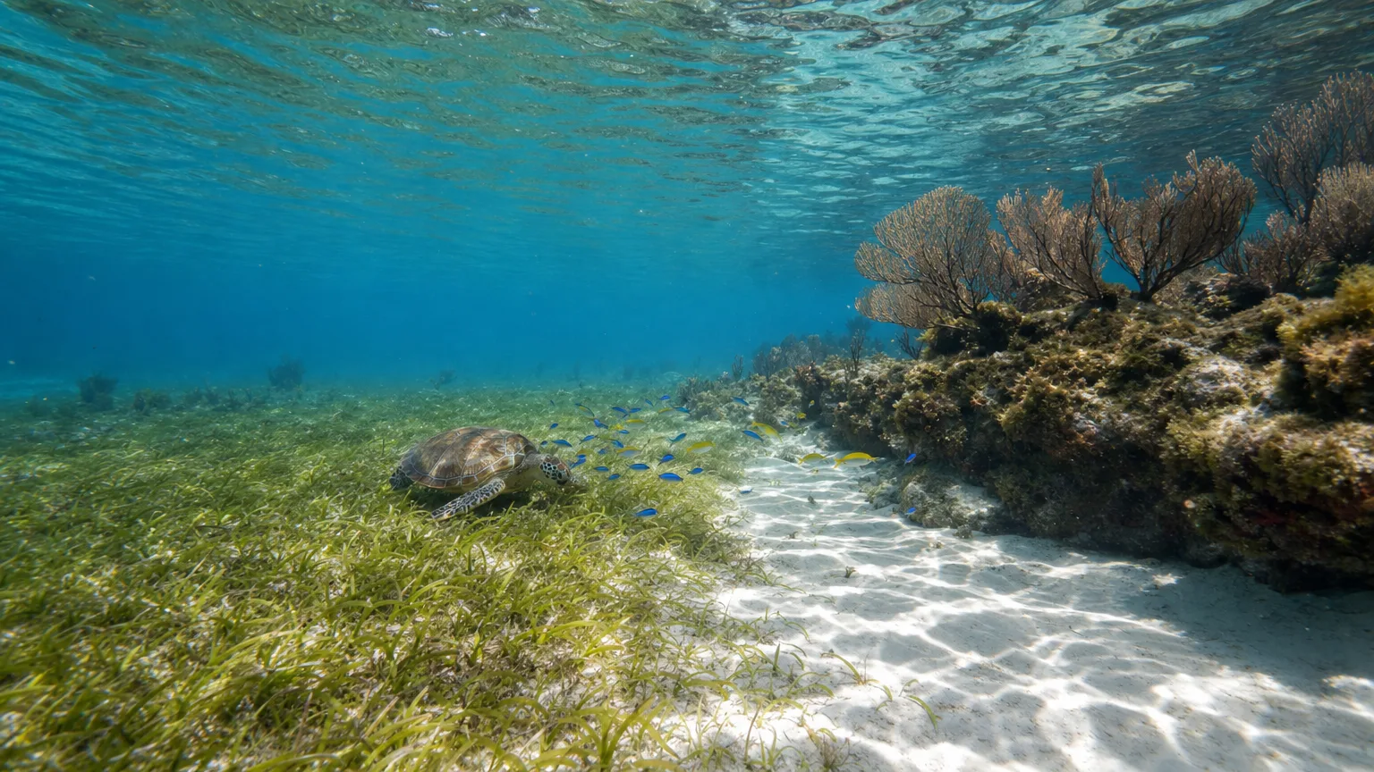
Surgeonfish and parrotfish are the two best-represented fish families on the trail (RNNSM, 2009). Behind the reef, in the shallow depression, it’s sergeant majors, damselfish, surgeonfish and ballyhoo, mostly adults, in numbers.
Turtles are regular here. The reserve’s survey records them as observed routinely in the back-reef depression, and it takes turtle feeding seriously enough that when it redrew its plans for the site in 2024, it dropped a proposed turtle-observation buoy specifically to preserve a quiet feeding zone (AGRNSM, 2024). Queen conch live in the mixed seagrass west of the islet, and the seagrass itself is a blend of turtle grass and manatee grass, which is exactly what the turtles are there for.
On the coral, expect a mosaic rather than a wall. The outer slope carries star coral and brain coral along with plaques of the encrusting zoanthid Palythoa caribaeorum; the eroded flat has small massive corals; the back-reef blocks hold fine colonies of finger coral. Gorgonians (the soft, branching sea fans) are particularly abundant on the shallower parts of the outer slope (RNNSM, 2009).
How Healthy Is the Reef at Pinel Island?
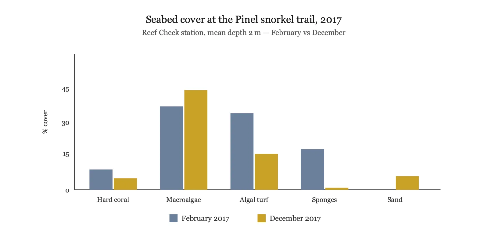
Not very, and it’s better to know that going in. The reserve monitors this exact spot as a Reef Check station, and in December 2017 it rated the site in poor health. Hard coral cover measured 5%, down from 9% in February that year, while macroalgae rose to 44%. Fish density halved over the same period, from 24.75 to 12.5 individuals per 100 m² (AGRNSM, 2017).
View data table
| Seabed cover | February 2017 | December 2017 |
|---|---|---|
| Hard coral | 9% | 5% |
| Macroalgae | 37% | 44% |
| Algal turf on rock | 34% | 16% |
| Sponges | 18% | 1% |
| Sand | 0% | 6% |
The categories plotted above do not sum to 100%. The remainder is recorded as “other,” which reached 27% in December 2017 and includes the encrusting zoanthids. Source: AGRNSM / Chalifour, Reef Check Saint-Martin, campagne post-Irma, 2017. Reef Check station on the Pinel underwater trail, mean depth 2 m.
Two things stop that being the whole story. The coral that is there is diverse and in good vitality: including both elkhorn and staghorn coral, with very rare signs of bleaching and no disease observed. And no lionfish has ever been recorded at this station, which is unusual and good news anywhere in the Caribbean (AGRNSM, 2017).
There’s a trap in the numbers worth naming, because the raw figures invite the wrong conclusion. Gorgonian density at this station fell from 273.25 individuals per 100 m² in 2016 to 46.25 in February 2017, a collapse of more than 80%. Hurricane Irma didn’t cause it. Irma struck in September 2017, seven months after that measurement, and the December reading ticked back up to 49.5 (AGRNSM, 2017).
What Are Pinel Island’s Beaches Like?
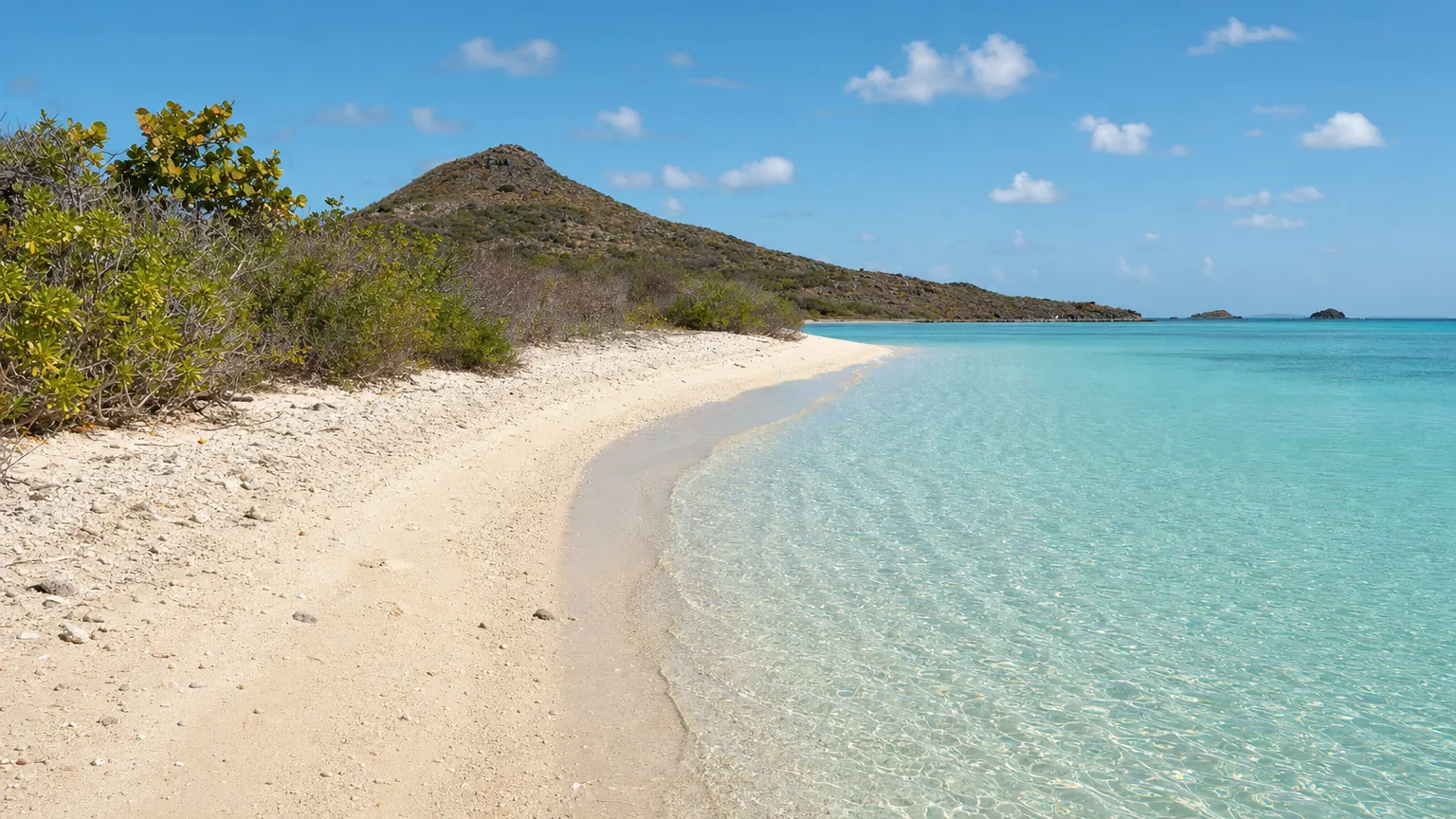
Pinel Island has four beaches, and only two of them get crowded. The west shore: the side facing St. Martin: carries two beaches separated by a sandy spit, and this is where the boats land, where the two beach restaurants sit, and where almost everyone stays. The north and east coasts have two further beaches, 200 m and 150 m long, which the reserve describes as narrower and less sheltered because they take the wind (RNNSM, 2009).
That trade-off is the most useful thing to know about the island. The sheltered Pinel Island beaches are the busy ones. If the trades are light and you want space, the wild beaches on the far side are a short walk and a completely different experience. If the wind is up, they’re exposed and you’ll want the west shore anyway.
A 1.5 km trail links three of the beaches, with interpretive panels along it and two orientation tables (RNNSM). There are shaded wooden shelters: carbets, along the way where you can get out of the sun (RNNSM). It’s a genuine walk rather than a stroll between sunloungers, and it’s the part of the island most day visitors skip entirely.
Two beach restaurants sit on the spit, and they’re the reason a lot of people come. Karibuni is the older of the two: an all-wood lunch restaurant opened in 1988, serving Creole seafood with lobster picked from a live tank, which makes it almost exactly as old as the food trade on the islet itself. Yellow Beach sits by the landing, serving seafood and cocktails under wooden huts among the palms (St. Martin Tourist Office).
They’re the only food and drink on the island, so reserving ahead in high season is sensible, and service winds down as the day boats thin out. If eating well is the whole point of your day, the lolos of Grand Case across on the main island are the French side’s real culinary event. Everything else on Pinel is sand, scrub, rock and water.
Are the Iguanas on Pinel Island Native?
Almost certainly not. The Lesser Antillean iguana, Iguana delicatissima, is listed by the reserve as potentially extinct on St. Martin, which notes that surviving descendants may carry genes from both species (RNNSM, 2014).
What displaced it wasn’t habitat loss in the usual sense. The introduced common green iguana, Iguana iguana, established itself and then interbred with the native species, swamping it genetically. Genetic work published in PLoS ONE reports no data for St. Martin specifically, but concludes the native species must have disappeared there before the common iguana arrived (Vuillaume et al., 2015). The native species still survives on neighbouring St. Eustatius, Anguilla, La Désirade, Petite Terre, St. Barthélemy and Dominica (RNNSM, 2014).
Reintroducing it to St. Martin is harder than it looks. The reserve notes the native iguana is too strong a swimmer to be safely confined to an islet close to shore, and the common iguana is already established on Tintamarre. The animals basking on Pinel’s rocks are a record of what happened here, not a glimpse of what used to live here. Île Fourchue, over toward St. Barts, tells the opposite kind of story: an islet that got its vegetation back once the grazing stopped.
What Pinel Was Before the Day Trips
People were eating conch on Pinel’s southwest beach long before anyone came for lunch. A pre-Columbian site was found there in 2000, and an archaeological evaluation directed by Dominique Bonnissent followed in 2002 (ADLFI, Ministère de la Culture). The finds included ceramics, a stone tool fragment, a thick flint flake, a pendant made from bivalve shell, and a mother-of-pearl amulet of a type characteristic of Saladoid sites.
The material is attributed to the late Cedrosan-Saladoid period, and the report is explicit that radiocarbon dating would be needed to fix an absolute date. The shells say what people were doing there: queen conch and West Indian topshell dominate the mollusc remains, and the excavator suggests the site was probably a small station, perhaps seasonal or periodic, tied to fishing and gathering from the sea. People came out to Pinel, worked the shallows, and went home, which, allowing for the centuries, is roughly what still happens.
The modern history is shorter than you’d guess. In the 1950s a local family began grazing goats on what was then a virgin islet, and later started landing visitors for a few hours. Snorkeling trips around the island date from 1976; equipment hire on the islet began in 1983, and the first food service arrived in the late 1980s (RNNSM, 2009). A cyclone in 1999 destroyed every structure then standing.
The sea has been rearranging the place too. The beach south of the spit retreated about 30 metres between 1986 and 2002, and the old shoreline is now visible offshore as a submerged bank of beach rock (RNNSM, 2009, citing Bonnissent 2003). The ground you stand on has moved within living memory.
When Is the Best Time to Visit Pinel Island?
Come before 10am or after 3pm. Boat traffic at Pinel concentrates between 10:00 and 15:00 (AGRNSM, 2024), and that five-hour window is when the island feels like a day-trip destination rather than an islet in a nature reserve.
The reserve’s 2009 study put visitor numbers at 200 to 300 people a day in low season and 400 to 500 in high season, with Sunday the busiest day of the week, and 150 people give or take in the snorkeling zone alone on a high-season day (RNNSM, 2009). Those figures are old and should be read as a shape rather than a current count, but the shape hasn’t changed: Sundays are busy, and the middle of the day is the crush.
Then it stops. The last shuttle leaves at 16:30 and the islet reverts to being deserted (RNNSM). Nobody stays. There’s no camping and no overnight use.
Seasonally, St. Martin averages 26.9°C with about 1,160 mm of rain a year under easterly trade winds (AGRNSM, 2017). There’s a drier stretch and a wetter, warmer hurricane season; the practical difference at Pinel is wind, because the exposed beaches and the crossing both feel it. Our guide to the best time to charter in the Caribbean breaks the seasons down month by month.
One more thing worth carrying in your head. On 6 September 2017, Hurricane Irma made landfall on St. Martin at an estimated 155 knots, about 178 mph, with a minimum central pressure of 914 mb, among the most intense Atlantic landfalls on record (NOAA National Hurricane Center, 2018). The island you visit today was rebuilt after that.
What Should You Bring to Pinel Island?
Everything you’ll need, because the island sells almost nothing beyond food and drink at the two beach restaurants. The short list:
- A mask. The single most valuable thing in your bag: the trail is the reason to be here, and it’s wasted without one.
- Sun cover you can carry. The walking trail has shaded shelters, but the beaches are open.
- Reef-safe sunscreen. You’re swimming inside a national nature reserve.
- Water shoes. Useful on the rockier stretches of the far-side beaches.
- A bag for your rubbish. What comes ashore with you leaves with you.
Rules That Change Your Day
Pinel sits inside a national nature reserve, and a handful of its rules shape what your day actually looks like:
- Nothing leaves the island. Fishing is prohibited across the reserve’s marine space, and the founding decree also bars damaging vegetation and collecting minerals and fossils. Shell collecting is treated as prohibited taking.
- No jet skis or water-skiing anywhere in the reserve.
- It’s a day stop. No camping, no overnight stays: the islet empties at 16:30.
- Boats keep off the seagrass. Anchoring is permitted only on bare sand. Larger yachts lie off and send guests in by tender.
Other Islands Near St. Martin
Pinel is one stop on a coast full of them, and the rest are close. North and west, Sandy Island off Anguilla is a strip of sand and palms in a marine park. South, Île Fourchue is the uninhabited counterpoint: no restaurant, no shade, nothing to buy at all. The seven-day St. Barts itinerary shows how they string together across a week.
Planning a Leeward Islands week with Pinel and the French side in it? Start a yacht search at Vital Charters or talk to a charter broker about where it fits.
Frequently Asked Questions
Where is Pinel Island?
Pinel Island lies just off the northeast coast of St. Martin, opposite the bay of Cul-de-Sac, on the French side of the island. It’s a few hundred metres offshore, the boat crossing takes five to ten minutes, and the islet sits inside the Réserve Naturelle Nationale de Saint-Martin.
Is Pinel Island in St. Martin or St. Maarten?
St. Martin. The island is divided between France and the Netherlands, and Pinel faces Cul-de-Sac on the French side. You’ll often see it written as “Pinel Island SXM” after the airport code, which covers the whole island, but the islet itself is in French territory.
How do you get to Pinel Island?
By boat, and only by boat. Small craft cross from Cul-de-Sac in five to ten minutes. Guests on a crewed yacht arrive by tender, because the approach has to be made through the channel between Green Cay and Pinel, and larger boats anchor off rather than close in.
What is there to do on Pinel Island?
Three things, mainly: snorkel the reserve’s marked underwater trail, walk the 1.5 km path linking the beaches, and swim off the sheltered west shore. Lunch at Karibuni or Yellow Beach is the fourth: they’re the only food and drink on the island. It’s a half-day to a full day, not an overnight stop.
Is there a snorkel trail at Pinel Island?
Yes. The nature reserve installed a marked underwater trail in 2009 along the islet’s southern point. It runs about 400 m in under 5 m of water, crossing sand, seagrass, reef and a small cave. The reserve runs it as a guided ecosnorkeling activity from the beach, with no scuba tanks involved.
Is the snorkeling good at Pinel Island?
It’s very good for beginners and mixed-ability groups, and honest expectations help. The water is two to three metres deep, sheltered and clear, with abundant surgeonfish and parrotfish, regular turtles and queen conch in the seagrass. Hard coral cover is low, the reserve measured 5% in December 2017, so come for the fish, the turtles and the habitat variety.
How many beaches are there?
Four. Two sit on the sheltered west shore either side of a sandy spit, and these are where the boats land and the crowds stay. Two more on the north and east coasts, 200 m and 150 m long, are narrower and take the wind. A 1.5 km trail links three of them.
What restaurants are on Pinel Island?
Two, both on the sandy spit on the west shore: Karibuni, an all-wood Creole seafood restaurant open since 1988 with a live lobster tank, and Yellow Beach, serving seafood and cocktails under wooden huts by the landing. They’re the only food and drink on the island, so reserving ahead is sensible in high season.
Can you stay overnight?
No. The islet empties when the last shuttle leaves at 16:30, and overnight stays are prohibited, as is camping. It’s a day stop, and the reserve is explicit that staying over isn’t permitted.
Can you take shells home?
No. Pinel is inside a national nature reserve where fishing is prohibited across the marine space, and the founding decree also bars damaging vegetation and collecting minerals and fossils. Shell collecting is treated as prohibited taking. Photograph it and leave it where it is.
Are there iguanas on Pinel Island?
Yes, but they aren’t the native Caribbean species. The Lesser Antillean iguana is listed as potentially extinct on St. Martin, displaced by the introduced common green iguana, which interbred with it. The iguanas you see are that introduced species and its descendants.
What is the best time to visit Pinel Island?
Before 10am or after 3pm. Boat traffic concentrates between 10:00 and 15:00, and Sunday is the busiest day of the week. Arriving late in the afternoon gives you warmer light, a thinning crowd and the snorkel trail largely to yourself.
The day trip that’s better when you don’t have to leave
The last boat back to Cul-de-Sac leaves at half past four, and Pinel goes back to being deserted. Anchor off the islet on a crewed charter and the quietest hours of the day are yours. We’ll build the St. Martin week around it.