
Île Fourchue: Best of St. Barts
Île Fourchue is the uninhabited island off St. Barts. Goats cut it to 16 plant species by 2001; it is back to 89. What a day there is like by yacht.
Last Updated: September 7, 2026
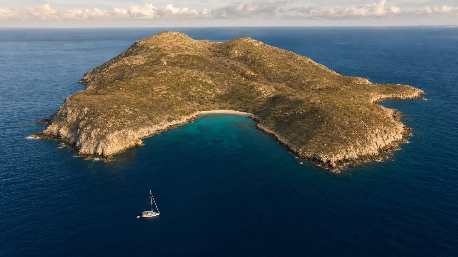
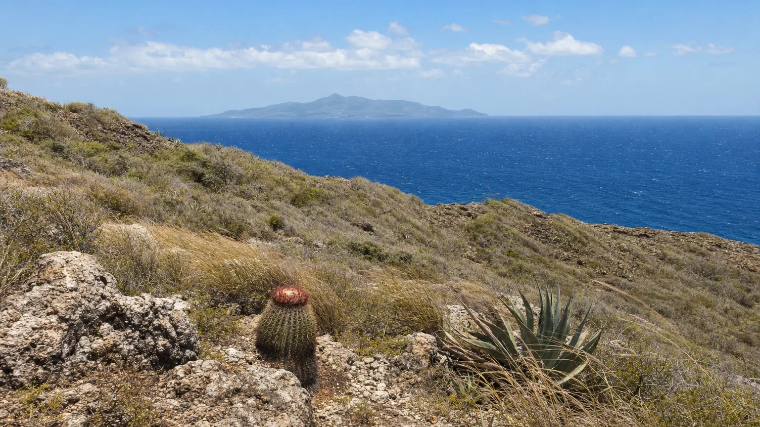
Île Fourchue (written Ile Fourchue without the accent in English, and sometimes Île Fourche) is an uninhabited island roughly five nautical miles northwest of Gustavia, sitting alone in the channel between St. Barts and St. Martin: a bare, wind-scoured place of dry scrub and rocky shore with a sand beach at the head of its bay. Nobody lives there. Nobody ever really has. For guests on a crewed charter it is the opposite of a beach club afternoon: no shade, no service, no one selling anything.
What Is Île Fourchue?
It’s the biggest of St. Barthélemy’s satellite islets: 56.74 hectares, cadastral parcel AB2, and privately owned (Agence Territoriale de l’Environnement, 2021). The territory has around 20 of these outlying rocks and islands, and Fourchue is both the largest and, in the agency’s own words, the most complex of them. It even has two dependencies of its own: Îlet au Vent off its eastern arm and La Petite Islette off the southwestern corner. It sits within the wider St. Martin and St. Barts charter destinations cruising ground.
A figure of 0.99 km² circulates widely for the island. The environment agency’s cadastral figure is 0.567 km², and that’s the number worth trusting.
Geologically it belongs to the first phase of the submarine volcanism that built St. Barthélemy, somewhere between roughly 51 and 24 million years ago (Agence Territoriale de l’Environnement, 2021): ash and lapilli welded into rock, with lava flows through it. The island’s habitats are classed as coastal cliffs and rocky shore, dry shrub, and dry grassland and thicket. Everything growing there is xerophilic: adapted to going without water.
Île Fourchue is the largest of St. Barthélemy’s roughly 20 satellite islets at 56.74 hectares, and it is privately owned. Its terrain is coastal cliff, rocky shore and dry xerophilic scrub, formed by the first phase of the submarine volcanism that built the territory (Agence Territoriale de l’Environnement, 2021).
The water around it is Zone 1 of the Réserve Naturelle Nationale de Saint-Barthélemy–Nicole Aussedat, created by decree on 10 October 1996 (Décret n° 96-885) and catalogued as France’s 132nd national nature reserve, RNN132 (Réserves Naturelles de France). The reserve is named for one of the five people who launched the campaign to create it in 1988 (Agence Territoriale de l’Environnement). The protected zone around Fourchue is marked by four buoys set 500 metres off the island in each cardinal direction, whose positions the decree lists individually, putting the island itself at roughly 17°57.6′N, 62°54.4′W (Décret n° 96-885).
Why Is Île Fourchue Green Again?
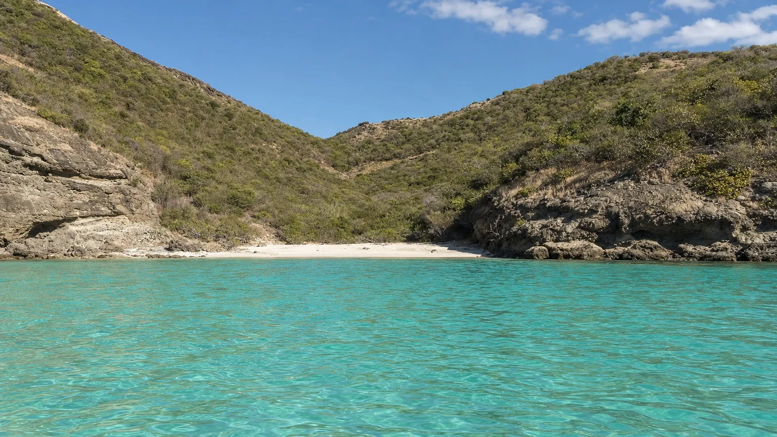
Because the goats are gone, and everything you can see growing has come back since 2004. This is the island’s real story, and it’s documented in numbers.
Fourchue was used as a goat pen in the 18th century (Agence Territoriale de l’Environnement, 2021, citing Tingbrand, 1995). The animals went feral and stayed for roughly two centuries, eating the island down. Botanical surveys tell the rest: 38 plant species recorded in 1980, and just 16 by 2001. The island’s private owners ran a capture campaign between 2003 and 2004 and removed the goats completely. The reserve’s own management plan logs it simply as “Éradication des caprins” for 2004.
View data table
| Year | Plant species recorded | Note |
|---|---|---|
| 1980 | 38 | Feral goats present |
| 2001 | 16 | Low point: a 57% decline over 21 years |
| 2003–04 | , | Owners remove the goats |
| 2011 | 26 | Early regrowth |
| 2017 | 73 | |
| 2018 | 89 |
Source: Questel K. & Hochart J., “La reconquête de la végétation sur l’Île Fourchue”, Bulletin de l’ATE n°4, 2019, reproduced in Agence Territoriale de l’Environnement, 2021.
What grows back is dry-country vegetation: the Turk’s-cap cactus, sea grape, the Lesser Antilles endemic Agave karatto, and lignum vitae, which the IUCN lists as Endangered (Agence Territoriale de l’Environnement, 2021).
Botanical surveys recorded 38 plant species on Île Fourchue in 1980 and only 16 by 2001, after two centuries of feral goats. The island’s owners removed the goats in 2003–04. The count reached 73 species by 2017 and 89 by 2018 (Questel & Hochart, Bulletin de l’ATE, 2019).
The recovery isn’t total. Some species recorded before the goats have not returned, and exotics have established in their place. But the green you see from the water is roughly twenty years old, and that is a genuinely unusual thing to be looking at.
What Can You Do on Île Fourchue?
Walk, swim and look: and that is genuinely the whole list. There is no restaurant, no bar, no water, no shade structure and no restroom anywhere on the island. The environment agency records the larger private islets as being used for snorkeling, picnics and walking, and Fourchue is the most accessible of them (Agence Territoriale de l’Environnement, 2021).
Of the places a crewed Caribbean charter can put you ashore in this archipelago, few ask less of you and give back more. Our guide to the best anchorages in St. Barts covers where boats end up around the main island; Fourchue is the outlier. Two things are worth understanding before you step off the tender.
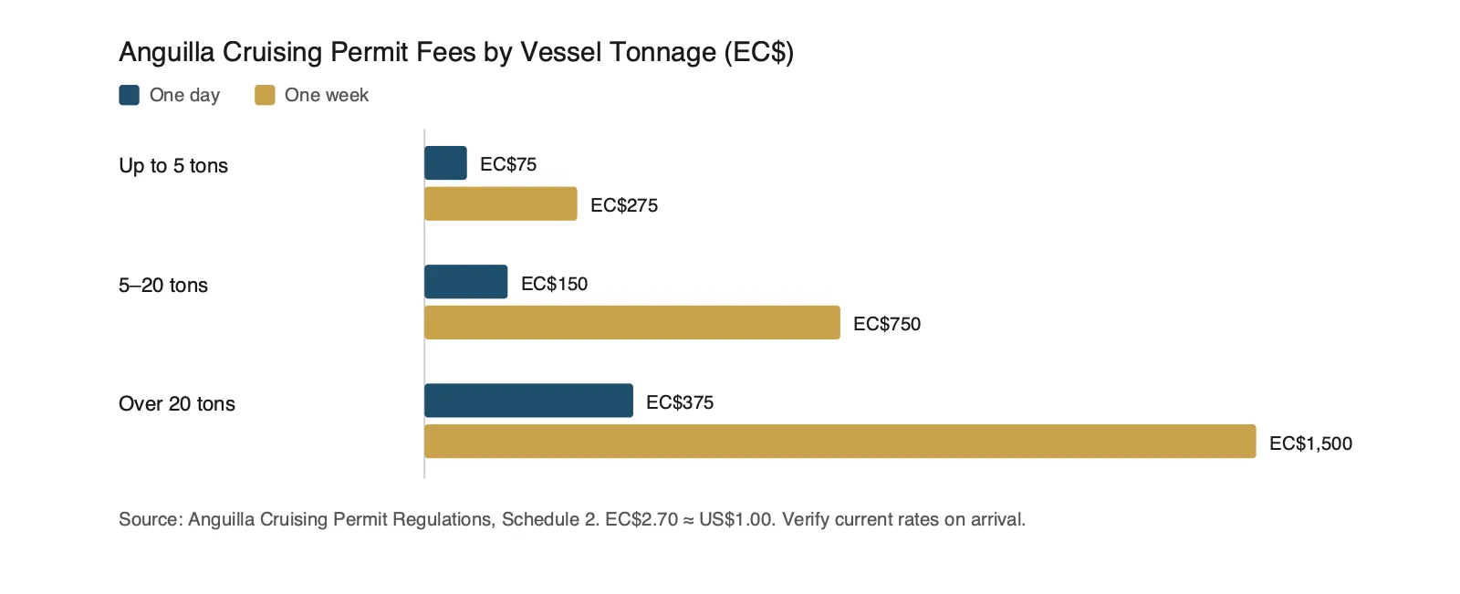
The first is that the island is private property. The reserve created in 1996 protects 1,200 hectares of water, all of it marine, across five sectors (Réserves Naturelles de France). The land itself has no protected status at all; as of the agency’s 2021 assessment, St. Barthélemy had no terrestrial protected area anywhere in the territory (Agence Territoriale de l’Environnement, 2021). You can walk on Fourchue because its owners permit it, not because it is public land. The agency puts it plainly: the owners of these islets allow people to go there, and none is currently exploited.
The second is that nothing leaves. Inside the reserve, collecting coral, plants, shells and crustaceans is prohibited, as is touching protected species, turtles, coral, sea urchins, starfish, sharks and rays. Damaging or removing plants is prohibited under the founding decree, as is harming wildlife, eggs or nests. Dogs are not allowed. Feeding animals is banned (Agence Territoriale de l’Environnement).
Hiking on Île Fourchue
As St. Barts hiking goes, this is the unmanicured end of it. The environment agency describes the terrain on these islets as steep and awkward, with access depending heavily on swell and wind, and no official body publishes a trail for Fourchue at all. You pick your own line up through the scrub.
What to Bring
Given there is nothing there:
- Water. The island has no springs and no streams. Nothing on it is drinkable.
- Real shoes. The ground is cliff, rock and dry thicket, and the agency describes the terrain on these islets as steep and awkward.
- Sun cover you can carry. The vegetation is knee- to shoulder-height scrub. There is no tree to sit under.
- A mask. The reason most of the day happens in the water rather than on the hill.
- A bag for your rubbish. Everything that comes ashore goes back to the boat.
You’ll find one piece of human history up there if you look: the remains of a buried cistern. It belonged to the only house ever built on the island, put up around 1790 by Aaron Ahlman, and nothing else of it survives (Agence Territoriale de l’Environnement, 2021, citing Tingbrand, 1995).
The island had a working life before that, and a strange one. In the 18th century Fourchue was a goat pen, a seabird-egg harvesting ground, and a place where people sick with smallpox were sent. By the 19th century it had become a crossroads for pirate, privateer and slave ships, and a transfer point for smuggled arms and gunpowder (Agence Territoriale de l’Environnement, 2021, citing Tingbrand, 1995). For a rock this size, that is a lot of history for something that was never really settled.
What Can You See in the Water at Île Fourchue?
Snorkeling at Île Fourchue
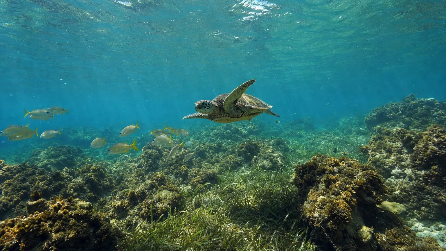
Turtles, most reliably. Green and hawksbill turtles are frequent throughout the reserve, and the environment agency has photo-identified more than 500 individual green turtles in St. Barthélemy’s waters between 2020 and 2024 (Agence Territoriale de l’Environnement). Leatherback nesting is occasionally observed, and humpback whales and bottlenose dolphins pass through reserve waters.
Reserve-wide, the numbers are substantial: 183 fish species, 51 coral species, among the richest in the French Antilles, 60 sponge species, 27 gorgonians and around 200 molluscs (Réserves Naturelles de France). A long-running survey of the territory’s reef communities from 2002 to 2018 also found a measurable “reserve effect” here: more species, more fish and greater biomass inside the protected water than outside it (Bouchon & Bouchon-Navaro, Université des Antilles / Agence Territoriale de l’Environnement, 2019).
The Réserve Naturelle de Saint-Barthélemy protects 183 fish species, 51 coral species, 60 sponges, 27 gorgonians and around 200 molluscs across 1,200 hectares of marine domain. Green and hawksbill turtles are frequent, and more than 500 individual green turtles were photo-identified between 2020 and 2024 (Réserves Naturelles de France; Agence Territoriale de l’Environnement).
An honest note, because almost nobody says it. The reserve’s coral is not in good shape. At the Baleine de Gros Îlets monitoring station, hard coral cover fell from 23% in 2018 to 8% in 2022, recovering slightly to 9% in 2023, with algal cover at 70% and the station rated “moyen à médiocre”, average to poor. At Les Petits Saints, cover dropped from 9% to 4% over the same window, then doubled back to 8% in 2023 (Agence Territoriale de l’Environnement / Reef Check France, 2023). The agency has since reported stony coral tissue loss disease and a bleaching episode in 2024 (Agence Territoriale de l’Environnement).
Two caveats matter here. Neither monitoring station is at Fourchue, no published station sits at the island itself, so read those figures as the regional picture rather than this particular bay. And the trend is not uniformly downward: both stations gained cover in 2023. Come for the fish and the turtles and the clear water, and set your expectations for the coral accordingly.
What Lives on Île Fourchue?
Seabirds
Seabirds, in numbers that outrank every other islet in the territory. A July 2021 survey counted 515 adult seabirds at Fourchue, birds of breeding species seen in flight or perched, out of 1,391 across all of St. Barthélemy’s islets, the largest count of any of them (Agence Territoriale de l’Environnement, 2021). Species logged there include brown booby, brown noddy, bridled tern, laughing gull, red-billed tropicbird, royal tern and Caribbean martin.
That last one is worth pausing on. Among St. Barthélemy’s islets, the Caribbean martin is recorded nesting at Fourchue and nowhere else, on its satellite La Petite Islette, to be precise (Agence Territoriale de l’Environnement, 2021).
La Petite Islette is a rock of just 1.135 hectares off Fourchue’s southwestern corner, and it is a designated Important Bird Area in its own right (BirdLife International), on the strength of its brown booby colony. American oystercatcher, magnificent frigatebird and white-winged dove have all been logged on it.
In the environment agency’s July 2021 seabird count, Île Fourchue held 515 of the 1,391 birds recorded across all of St. Barthélemy’s islets: more than any other. The Caribbean martin nests on just two islets in the territory: Fourchue and its satellite La Petite Islette, itself a designated Important Bird Area.
Iguanas and Reptiles
The island is also a lifeboat for a critically endangered reptile. In 2011 the environment agency translocated Lesser Antillean iguanas (Iguana delicatissima), listed by the IUCN as Critically Endangered, adding 13 animals to Fourchue’s weakened population (Agence Territoriale de l’Environnement). Several generations have been born there since. Every animal carries a microchip, and monitoring has run annually since. Two other reptiles live alongside them: the Anguilla Bank anole and Plée’s ameiva.
Not everything introduced has been removed. House mice and black rats are established on Fourchue, and the agency believes they suppress seabird breeding by taking eggs and chicks (Agence Territoriale de l’Environnement, 2021). The goats are gone; the rodents are not.
There is a link between the two halves of the island that is easy to miss. The environment agency’s scientific case for protecting these islets is that seabird guano delivers nitrogen to the corals below, and the official survey sheet for the islets records that at Fourchue the biological quality of the surrounding water tracks the state of the island’s plant cover (INPN, ZNIEFF 010000034). Vegetation holds the birds; the birds feed the reef.
When Should You Visit Île Fourchue?
January to April. That’s St. Barthélemy’s dry season: the Carême, running January to April, against a wet season from June to November, with May and December transitional (Météo-France). On an island with no shade and no water, the difference is not academic.
Dry-season temperatures on the Northern Islands run lows of 21–24 °C and highs of 28–31 °C; in the wet season that rises to lows of 25–27 °C and highs of 31–33 °C. Sea temperature stays between 26 °C and 29 °C all year (Météo-France). Météo-France’s 1991–2020 normals for the St. Barthélemy climate station give 1,174 mm of rain a year across 130 days, with 2,117 hours of sunshine (Météo-France).
Atlantic hurricane season runs 1 June to 30 November and peaks around 10 September, with most activity between mid-August and mid-October (NOAA National Hurricane Center): which overlaps the wet season almost exactly.
St. Barthélemy’s dry season runs January to April, with lows of 21–24 °C and highs of 28–31 °C, and sea temperature between 26 °C and 29 °C year-round. Atlantic hurricane season runs 1 June to 30 November, overlapping the wet season almost exactly (Météo-France; NOAA).
It is one of the few stops inside the reserve that a charter week can build a whole day around, which is why it turns up on itineraries at all. The seven-day St. Barts charter itinerary puts it in sequence with the rest of the island.
For the contrast, the same week can take in Shellona on Shell Beach or Nikki Beach at Saint-Jean, both of which have a kitchen, and neither of which asks you to bring your own water.
Other Islands Near St. Barts
Of the islands near St. Barts, Fourchue is the one a crewed week most often builds a whole day around, but it is not the only uninhabited stop in the archipelago. Sandy Island off Anguilla is the same idea in a different key: a sandbar with one restaurant, inside another country’s marine park. North on St. Martin, the lolos of Grand Case are the opposite proposition entirely: a village street of open-air grills where the only thing you need to carry is cash. Around that island’s northeast corner, Pinel Island splits the difference: an uninhabited nature-reserve islet with a marked snorkel trail in chest-deep water and two beach restaurants on the sand.
Planning a Leeward Islands week with Île Fourchue in it? Start a yacht search at Vital Charters or talk to a charter broker, and we’ll build the crewed charter around it.
Frequently Asked Questions
Where is Île Fourchue?
Île Fourchue lies roughly five nautical miles northwest of Gustavia, in the channel between St. Barts and St. Martin. It belongs to the Collectivité of Saint-Barthélemy and is the largest of the territory’s roughly 20 satellite islets, at 56.74 hectares. The water around it forms Zone 1 of the island’s national marine reserve.
Can you go ashore?
Yes, and people do: but the island is private property, not public land. The environment agency records that the owners of these islets permit people to visit and that none is currently exploited commercially. The marine reserve protects the surrounding water; the land itself has no protected status.
Is there anything on the island?
No public facilities of any kind: no water, no shade structures, no restrooms, no restaurant or bar. The island has no springs and no streams. The only trace of human building is the remains of a buried cistern from a house put up around 1790. Bring everything you need and take it away again.
Why were the goats removed from Île Fourchue?
Because they had eaten the island down. Fourchue was used as a goat pen in the 18th century and the animals went feral. Plant surveys recorded 38 species in 1980 and just 16 by 2001. The island’s private owners ran a capture campaign in 2003–04 that removed them completely, and the vegetation has been recovering since.
Can you collect shells?
No. Collecting coral, plants, shells and crustaceans is prohibited throughout the Réserve Naturelle de Saint-Barthélemy, on the shore and underwater. Touching protected species (turtles, coral, sea urchins, starfish, sharks and rays) is also forbidden, as is harming wildlife, eggs or nests. Dogs are not permitted.
Is the snorkeling good here?
The marine life is the main reason to be in the water. Green and hawksbill turtles are frequent in reserve waters, and the reserve protects 183 fish species and 51 coral species. Be realistic about the coral: the reserve’s two published monitoring stations (both elsewhere in the reserve, not at Fourchue) recorded hard coral cover between 4% and 9% in 2022–23, rated average to poor.
Which seabirds are counted on Île Fourchue?
More than on any other islet in St. Barthélemy. A July 2021 survey counted 515 adult seabirds there out of 1,391 across all the territory’s islets, including brown booby, brown noddy, bridled tern, red-billed tropicbird and royal tern. The Caribbean martin is recorded nesting at Fourchue and nowhere else in the territory.
Are there iguanas?
Yes. The Lesser Antillean iguana, listed by the IUCN as Critically Endangered, lives on the island. In 2011 the environment agency added 13 animals to reinforce a weakened population, and several generations have been born there since. Every individual is microchipped and monitored annually.
Was Île Fourchue ever inhabited?
Never really. In the 18th century it served as a goat pen, a seabird-egg harvesting ground and a place where people sick with smallpox were sent. In the 19th century it was a crossroads for pirate, privateer and slave ships. One house was built around 1790; only a buried cistern remains.
An uninhabited island that grew itself back
Île Fourchue has no dock, no road and no way to arrive except by boat, which is why a crewed week is the only comfortable way to spend a day there. We’ll build the St. Barts itinerary around it.