
Windward vs. Leeward Islands: Which Chain Should You Sail?
Windward vs leeward islands: which islands are in each chain, why the names look backwards, and why Aruba, some 550 miles away, belongs to neither of them.
Last Updated: October 18, 2026
Windward vs leeward islands is a geography question with a sailing answer. The Leeward Islands are the northern arc of the Lesser Antilles, running from the Virgin Islands down to Guadeloupe, and the Windward Islands are the southern arc, from Dominica down to Grenada (Britannica). What the encyclopedia entries leave out is the part that decides your week: the Leewards are a short-hop chain in sheltered water, and the Windwards put real open ocean between one island and the next.
Both chains sail in the same season and draw from the same crewed fleet, so this isn’t a question of one being better. It’s a question of pace. Our guide to the region’s crewed charter grounds covers the wider picture.
What’s the difference between windward and leeward?
Windward means facing into the prevailing wind, leeward means sheltered from it. As NOAA puts it, “an island’s windward side faces the prevailing, or trade, winds, whereas the island’s leeward side faces away from the wind” (NOAA National Ocean Service, 2024). In the Caribbean those two words do double duty, and that’s the root of the confusion.
The first job is describing one island. Trade winds pick up moisture crossing the Atlantic, drop it climbing the eastern slopes, then warm and dry coming down the western side. NOAA calls that the orographic effect, and it’s why Dominica’s east coast is rainforest while its west coast is where you anchor.
The second job is naming two groups of islands, and those names are historical rather than meteorological. The trades blow east to west across the whole Caribbean, so both chains face the same wind and neither sits in the other’s shelter.
Which islands are the Leeward Islands?
The Leeward Islands are the northern and westernmost arc of the Lesser Antilles, lying between 16 and 19 degrees north (Britannica). From north to south they are the U.S. and British Virgin Islands, Anguilla, St. Martin and Sint Maarten, St. Barthelemy, Saba, Sint Eustatius, St. Kitts and Nevis, Antigua and Barbuda, Montserrat, and Guadeloupe.
This is where most Caribbean charters happen, and the distances explain why. Out of Tortola, Norman Island is six nautical miles away and The Baths on Virgin Gorda about ten. Anegada, the longest leg of a standard seven-day BVI route, is eighteen, and nearly all of it sits inside the Sir Francis Drake Channel with land on both sides.
The British Virgin Islands and U.S. Virgin Islands anchor the top of the chain and are geologically part of the Greater Antilles, a reminder that these groupings were drawn by sailors, not geologists.
Here’s what’s open in the crewed fleet right now.
Which islands are the Windward Islands?
The Windward Islands form the southern arc of the Lesser Antilles, between 12 and 16 degrees north: Dominica, Martinique, St. Lucia, St. Vincent, the Grenadines, and Grenada (Britannica). Barbados sits well east of the chain and is usually counted with them, though it isn’t physiographically part of the arc.
These islands are taller, wetter and greener than the Leewards, and spaced much further apart. They also have a boundary problem: Britain administered Dominica as part of the Leewards for decades before moving it to the Windwards in 1940, which is why old maps and new ones disagree. The line between the chains is an administrative decision, not a natural feature.
The Grenadines are the exception that catches people out. A seven-day Grenadines route covers less water than a week in the BVI, and we’ll come back to why.
Why the names seem backwards
The names describe a transatlantic voyage, not a local breeze. Sailing ships crossing on the trade winds ran west-northwest and made landfall on the southeasternmost islands first, so those became the Windwards, and everything downwind to the northwest became the Leewards (Wikipedia). The split dates to Spanish colonization in the late 1400s and was later adopted by the French, Dutch and British.
On a modern chart it makes no sense. The Leewards are north, the Windwards are south, and the wind comes from the east. Nothing is downwind of anything.
Translation muddies it further. In Dutch, French and Spanish the whole Lesser Antilles chain is called the Windward Islands, and the name Leeward Islands goes to a different group off South America. English usage is one convention among several, not the correct one. (There’s a separate Leeward Islands group in French Polynesia too, unrelated to any of this.)
Is St. Lucia windward or leeward?
St. Lucia is a Windward Island, sitting at roughly 14 degrees north between Martinique and St. Vincent (Britannica). Nothing about that is ambiguous.
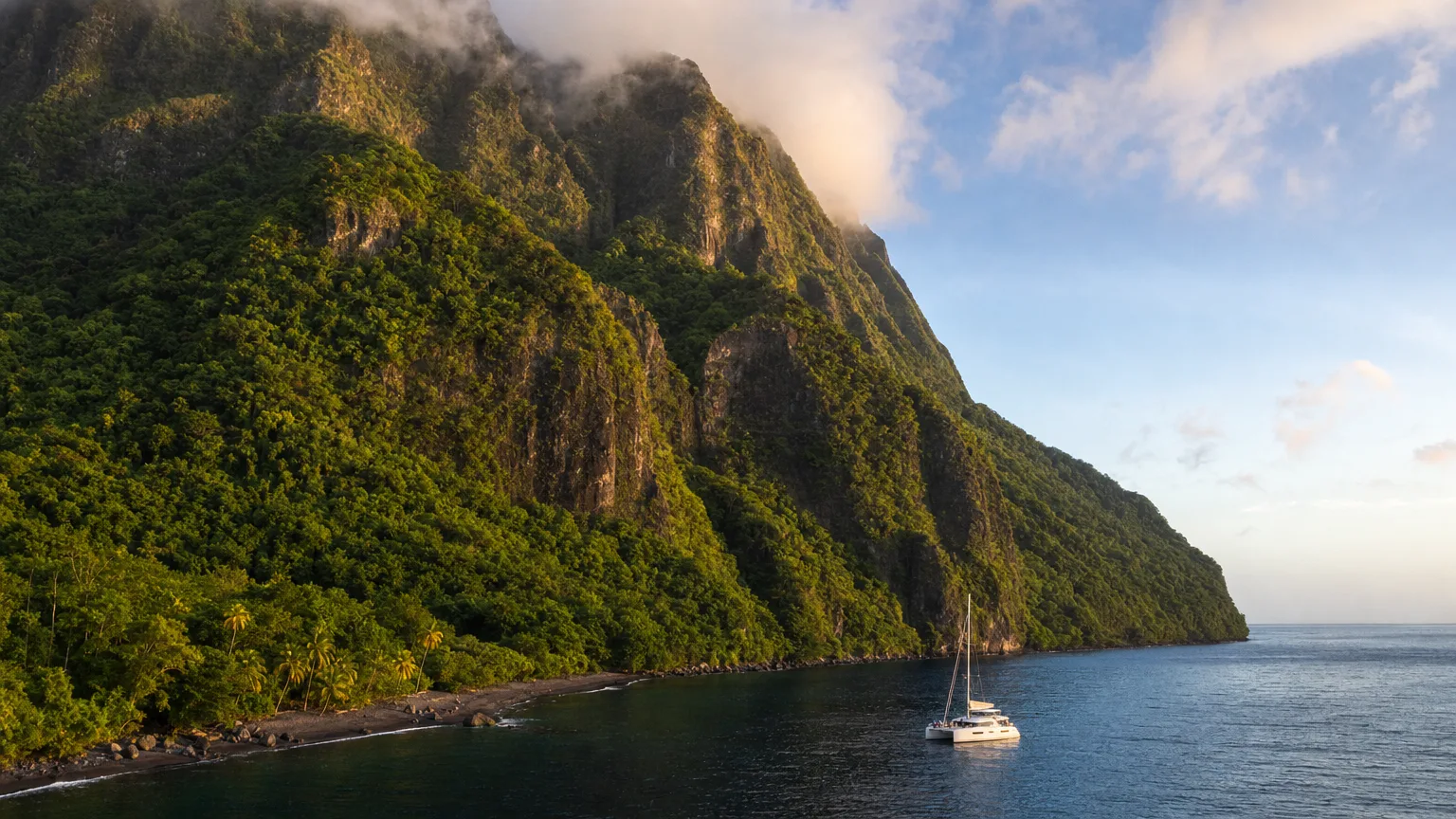
What confuses people is that almost everything you do there happens on its leeward side. Rodney Bay, Marigot Bay and the anchorage under the Pitons all sit on the sheltered west coast, so you can spend a week on a Windward Island and never once be in windward conditions.
That’s the distinction worth carrying. Every island in both chains has a calm west coast and an exposed east one, because the trades hit the eastern shore first. A crewed itinerary runs down the calm side of each island and crosses the open channels in between, which is why the group name tells you about the passages rather than about the anchorages.
Is Aruba a Leeward Island?
No. Aruba belongs to the Leeward Antilles, a separate island group along the Venezuelan coast, and Wikipedia’s own entry warns that it is “not to be confused with the Leeward Islands (also of the Lesser Antilles) to the northeast” (Wikipedia). Aruba sits roughly 550 nautical miles southwest of Antigua.
The Leeward Antilles are the ABC islands, Aruba, Bonaire and Curacao, plus Margarita and a scatter of Venezuelan dependencies. They run east to west just north of South America, not north to south like the Lesser Antilles.
The error is a translation artifact: in Spanish and Dutch these are the leeward islands and the Lesser Antilles arc is windward. Translate both without adjusting for the different system and Aruba lands in the wrong group.
How the two chains actually sail
The difference a guest notices is time. In the Leewards most hops run six to twenty nautical miles inside sheltered channels, an hour or two, usually before lunch. Between the large Windward islands the crossings run twenty-two to sixty-five nautical miles of open water. That’s most of a day.
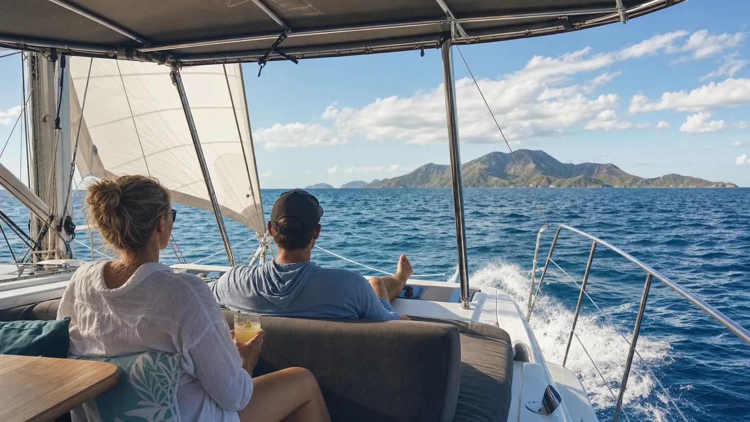
In the Leewards you wake at anchor, move a short distance in flat water with land on both sides, and are swimming again by early afternoon. Crossing from Martinique to St. Lucia, or St. Lucia to St. Vincent, means several hours in ocean swell with nothing to windward for 3,000 miles. Anyone in your group who gets seasick will feel it.
There’s a real trade for it: the Windwards are emptier. A BVI anchorage in February can hold forty boats. The same night further south you might share a bay with four.
What a day aboard actually involves doesn’t change with latitude. Your captain handles the boat, the passages and the paperwork. What changes is how much of the week you spend under way.
Which chain should you charter?
Charter the Leewards for a first charter, a group with mixed ages or young children, or anyone prone to seasickness. Charter the Windwards if you’ve done this before, want fewer boats around you, and don’t mind spending real hours on passage to get it.
| Leeward Islands | Windward Islands | |
|---|---|---|
| Where | Virgin Islands to Guadeloupe, 16°N to 19°N | Dominica to Grenada, 12°N to 16°N |
| Typical hop | 6 to 20 nautical miles | 22 to 65 nautical miles between the large islands |
| Time under way | One to two hours, usually before lunch | Most of a day on the big crossings |
| Water | Sheltered channels, land in sight both sides | Open ocean swell |
| Terrain | Drier, flatter, more coral | Volcanic peaks, rainforest, waterfalls |
| Anchorages | Busy in high season | Noticeably emptier |
| Best for | First charters, mixed ages, anyone who gets seasick | Repeat charterers who want space |
| Strongest months | December to May, trades are absorbed by the channels | March to May, once the winter trades ease |
The Leeward case is protection and choice. The Virgin Islands hold the densest concentration of good anchorages in the Caribbean charter region, close enough together that a bad forecast means a different bay rather than a lost day. Further down the chain, St. Martin and St. Barts add restaurants and nightlife the Windwards mostly don’t have. Our comparison of three charter regions goes deeper.
The Windward case is scenery and space. Dominica’s rivers, the Pitons, the reef at the Tobago Cays and Bequia’s boatbuilding town are places people describe for years afterward, and you’ll see more local fishing boats than charter yachts. Look through the crewed yachts we place clients on and you’ll notice the southern boats run a size up, because the passages ask for it.
When to sail each
Both chains charter from December through May. The Atlantic hurricane season runs June 1 to November 30, peaks on September 10, and concentrates most activity between mid-August and mid-October (NOAA National Hurricane Center). Crewed programs shape their Caribbean season around those dates, which is why the calendar looks alike in both chains.
Inside that window the chains don’t feel the same month to month. December through February brings the strongest trades of the year. In the exposed Windward crossings that decides how a passage feels; in the protected Leeward channels a stiff forecast mostly just means a faster sail. March through May is the calmer half, and it’s when the southern chain is at its best.
Cost is not what should decide this. Match the boat and the two chains price within a few thousand dollars of each other: a 50 to 59 ft all-inclusive catamaran, the boat most charter parties book, medians $30,500 for the week in the Leewards and $28,000 in the Windwards, on interquartile ranges of $27,000-$32,000 and $26,000-$32,000 that overlap almost entirely (50 and 46 priced listings, Vital Charters rate analysis, October 2026). Pooled across every hull the gap looks bigger, $51,194 against $48,675 (September 2026), but that is fleet mix rather than price: 23% of the Leeward listings are motor yachts against 18% in the Windwards. What does differ is choice. The Leewards carry 199 priced crewed listings for the 2026-27 high season against 166 in the Windwards, so the harder your requirements, the more the northern chain has to offer. See what a week costs by destination, or our month-by-month guide to Caribbean conditions.
Windward and Leeward Islands map
The map below plots all three groups from real coordinates, including the Leeward Antilles, which rarely appear alongside the other two despite the near-identical name.
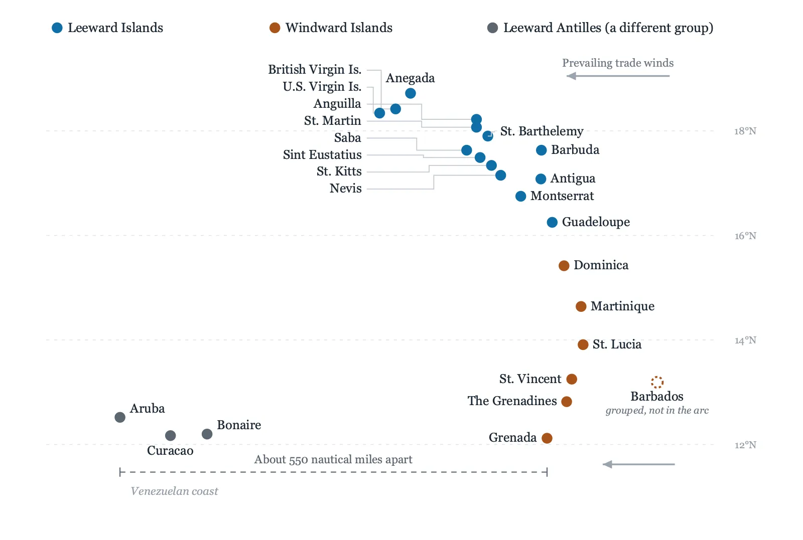
View data table
| Group | Where it runs | Islands |
|---|---|---|
| Leeward Islands | Northern Lesser Antilles, 16°N to 19°N | U.S. and British Virgin Islands, Anguilla, St. Martin and Sint Maarten, St. Barthelemy, Saba, Sint Eustatius, St. Kitts and Nevis, Antigua and Barbuda, Montserrat, Guadeloupe |
| Windward Islands | Southern Lesser Antilles, 12°N to 16°N | Dominica, Martinique, St. Lucia, St. Vincent, the Grenadines, Grenada. Barbados is grouped with them but sits east of the arc. |
| Leeward Antilles | Off the Venezuelan coast, about 550 nautical miles southwest | Aruba, Bonaire, Curacao, Margarita and the Venezuelan dependencies. A separate group, not the Leeward Islands. |
Frequently Asked Questions
What is the difference between the Windward and Leeward Islands?
The Leeward Islands are the northern arc of the Lesser Antilles, from the Virgin Islands to Guadeloupe. The Windward Islands are the southern arc, from Dominica to Grenada. The Leewards are drier and flatter with short sheltered passages; the Windwards are mountainous and wet with long open crossings.
Which islands are in the Leeward Islands?
The U.S. and British Virgin Islands, Anguilla, St. Martin and Sint Maarten, St. Barthelemy, Saba, Sint Eustatius, St. Kitts and Nevis, Antigua and Barbuda, Montserrat, and Guadeloupe.
Which islands are in the Windward Islands?
Dominica, Martinique, St. Lucia, St. Vincent, the Grenadines, and Grenada. Barbados is usually grouped with them but sits east of the arc.
Is St. Lucia a Windward or Leeward island?
St. Lucia is a Windward Island. Its charter anchorages, including Rodney Bay, Marigot Bay and the Pitons, are all on its sheltered leeward coast.
Is Aruba a Leeward Island?
No. Aruba is part of the Leeward Antilles off the Venezuelan coast, a separate group about 550 nautical miles from the Leeward Islands of the Lesser Antilles. The two get confused because of how the names translate between languages.
Is Barbados a Windward Island?
Barbados is conventionally grouped with the Windward Islands, but sits about 90 miles east of the chain and isn’t part of the volcanic arc.
Are the Windward Islands harder to sail than the Leeward Islands?
The passages are longer and more exposed, so a Windward week means more hours under way in ocean swell. Your captain handles that, but guests feel the motion, which is why the Leewards suit first-timers better.
Find the right week afloat
Tell us your dates and how many are travelling, and we will match the chain and the yacht to the week you actually want.