
Sandy Island: Best of Anguilla
Sandy Island Anguilla is a palm-topped sandbar in a marine park, reachable only by boat, with one restaurant on it. What a day there is like by crewed yacht.
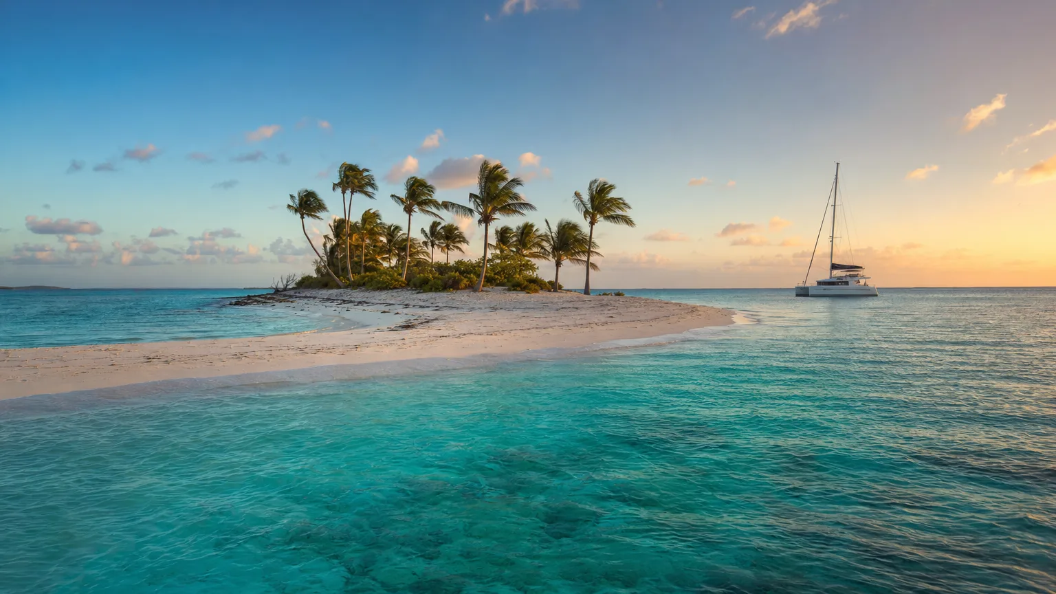
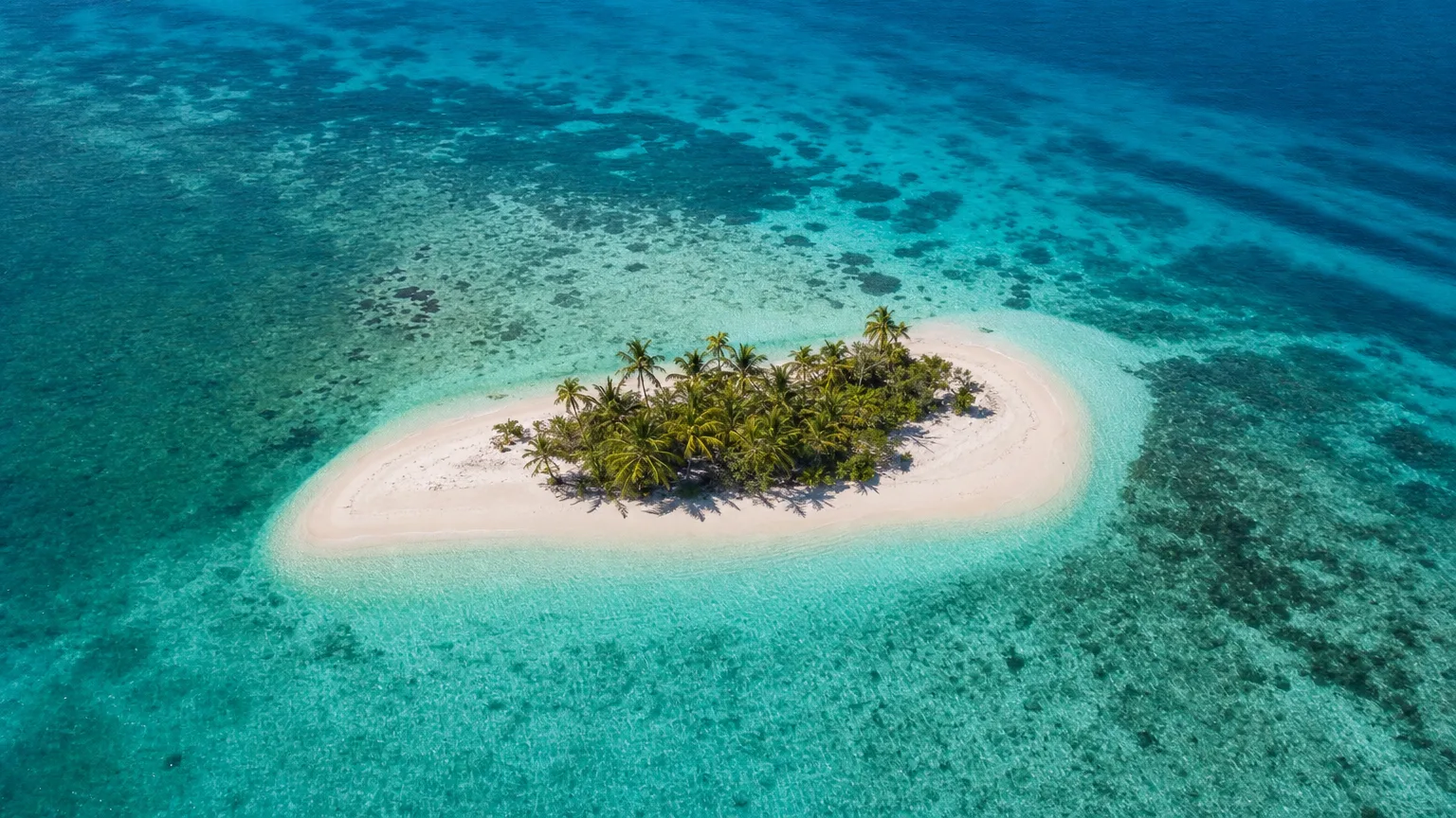
Sandy Island, Anguilla’s best-known offshore cay, is a strip of white sand and coral rubble a short run off Sandy Ground, reachable only by boat, protected inside a statutory marine park, and home to exactly one restaurant. It’s the postcard version of a Caribbean sandbar: a handful of palms, turquoise shallows, and nothing else. Reaching it on a crewed charter is one of the easier pleasures of a Leeward Islands week. This guide covers what the cay is actually like, what there is to do once you’re on it, and how an afternoon there fits into a week aboard a crewed Caribbean charter.
What Is Sandy Island, Anguilla?
Sandy Island is a cay “made entirely of sand and coral fragments/rubble,” situated “only a few km north-west from mainland Anguilla,” according to the Government of Anguilla’s Department of Fisheries and Marine Resources. That’s not poetic license: it’s the official habitat description. There’s no rock core and no elevation to speak of. The cay is a pile of reef-derived sediment sitting in shallow water, a few hundred meters of beach with a cluster of palms in the middle.
It sits inside the Sandy Island Marine Park, one of seven marine parks Anguilla has designated by statute, covering roughly five square kilometers. Schedule 1 of the regulations fixes the park’s boundaries by coordinate, running from 18°12′06″N to 18°13′00″N and from 63°06′49″W to 63°08′25″W, a useful detail, given how many other places in the Caribbean are also called Sandy Island.
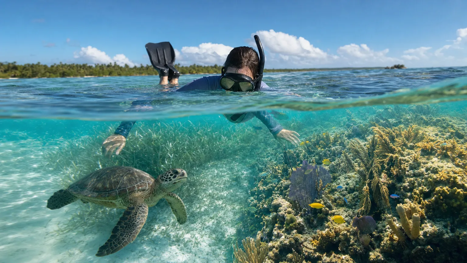
The surrounding seabed is a mix of sand and rubble, seagrass beds, patch reefs, and deeper reef. That includes a feature called Dowling Shoal, which the department describes as having “variable hard and soft coral communities and a wide variety of reef fish species.” It’s also juvenile habitat for green and hawksbill turtles, with a small amount of nesting on the cay itself.
Sandy Island is a small offshore cay a few kilometers northwest of mainland Anguilla, made entirely of sand and coral rubble. It sits inside the statutory Sandy Island Marine Park, roughly five square kilometers of sand, seagrass, patch reef and deeper reef that serves as juvenile habitat for green and hawksbill turtles. (Anguilla Dept. of Fisheries and Marine Resources)
Two practical details are worth knowing up front. The main island is privately owned, and, in the department’s own words, “one restaurant operates here also.” That single operation is the entire built environment of the island. Everything else is sand.
Why Sandy Island Keeps Getting Rebuilt
Sandy Island rebuilds because the reef around it keeps manufacturing the sand it’s made of. Cays like this form where waves and tidal currents push loose sediment across a reef top to a spot where it piles up above the tide line, and storms are generally erosive on them. Whether one recovers afterward comes down to sediment supply, a dynamic the USGS documents in its work on the role coral reefs play in shoreline stability. Sandy Island is, in a real sense, a landform maintained by its own reef. That’s a large part of why Anguilla regulates the water around it so tightly.
The most recent test was severe. Hurricane Irma’s northern eyewall struck Anguilla on 6 September 2017, leaving roughly 90% of the territory’s roads impassable and causing at least $190 million in losses, according to National Hurricane Center post-storm reporting. Forbes Travel Guide reported that the cay “once had coconut trees, plants and a shaded alfresco dining area,” and that “the storm left it a barren strip of white sand.” The family-run operation rebuilt a kitchen, bathrooms, and shade structures; the restaurant was reported back open in April 2018, roughly seven months after the storm.
There’s a second reason this particular cay is exposed. It sits off Anguilla’s northwest, leeward side, which normally faces away from Caribbean weather. But NOAA’s report on Hurricane Lenny (the November 1999 storm that ran the wrong way across the Caribbean, west to east, the first in the 113-year record to do so) noted that its “approach from the west produced unprecedented wave and storm surge impact on westward-facing coasts and harbors.” The sheltered side isn’t always the sheltered side.
Getting to Sandy Island by Yacht
Sandy Island sits about 10 to 15 minutes by boat from Sandy Ground, on Anguilla’s northwest coast, and getting there means crossing an international border. Anguilla is a self-governing British Overseas Territory with its own customs, immigration and currency, entirely separate from St. Martin or Sint Maarten (Anguilla Tourist Board). Crossing the Anguilla Channel means entering another jurisdiction, passports and all.
For guests, that translates into exactly one thing to remember: bring your passport. Everything else (clearing the yacht in at Road Bay, the permits, the port formalities) is the captain’s job, and it happens before anyone steps ashore. Boats coming from St. Martin run to Road Bay first, clear in there, and only then head out to the cay.
Road Bay matters for a second reason. Because no boat can stay in the marine park overnight, Road Bay is where the yacht spends the night, so a Sandy Island day is really a Road Bay overnight with an afternoon on the sandbar attached. Depending on the size of the boat, you may go across to the cay by tender rather than have the yacht sit off it.
Anguilla is a self-governing British Overseas Territory with its own customs and immigration, separate from St. Martin and Sint Maarten. Everyone aboard needs a valid passport. Yachts clear in at Road Bay, roughly 10 to 15 minutes from Sandy Island, and the crew handles the formalities before guests go ashore. (Anguilla Tourist Board)
What the Marine Park Means for Your Day
Mainly two things: you can’t sleep there, and you can’t take anything home. No boat may stay in an Anguillian marine park between 7 p.m. and 6 a.m., under the Marine Parks Regulations. Sandy Island is a day stop by law, which is why charters base themselves in Road Bay and come out for the afternoon.
The rest of the rulebook shapes what you can do once you’re in the water. Snorkelling and swimming are the whole point: the Department of Fisheries and Marine Resources notes the area “is heavily visited by tourist charters and popular with snorkelers.” Beyond that, inside the park:
- Nothing leaves. Removing any flora or fauna is prohibited, and that explicitly includes coral and shells.
- No spearfishing, conch fishing or trap fishing. Hook-and-line is permitted.
- No water skiing or towed watersports.
- No fires and no litter.
It’s a stricter regime than most of the region’s hidden Caribbean anchorages, and it exists precisely because the cay depends on the reef around it. The same reef that keeps rebuilding the sand you’re standing on.
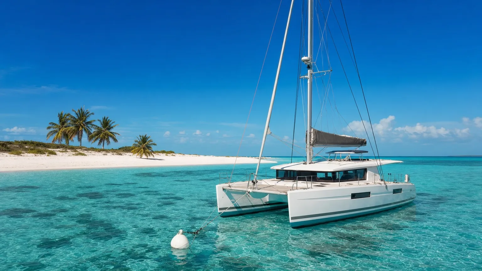
Anguilla’s Marine Parks Regulations prohibit boats from staying in a marine park between 7 p.m. and 6 a.m., making Sandy Island a day stop by law. Inside the park, spearfishing and water skiing are prohibited, and removing any flora or fauna, coral and shells included, is not allowed. (Anguilla Marine Parks Regulations)
What It’s Actually Like Ashore
There’s one restaurant on the cay and nothing else: a fact confirmed in the government’s own marine park management plan. Before Irma, Forbes described a shaded alfresco dining area serving local lobster, shrimp, and rum punch. The rebuilt operation runs from a kitchen with restrooms, shade structures, a solar system, and its own water supply. It operates under a marine park business permit, which is a licensed category under the regulations.
One restaurant operates on Sandy Island and nothing else, per Anguilla’s official marine park management plan. Rebuilt after Hurricane Irma, it runs from a kitchen with restrooms, shade structures, a solar system and its own water supply, under a marine park business permit. The rest of the cay is sand and palms. (Anguilla Dept. of Fisheries and Marine Resources)
The department notes the area “is heavily visited by tourist charters and popular with snorkelers,” and that’s the honest picture: this is a well-known stop, not a secret one. The snorkeling works because of what surrounds the cay rather than the beach itself, patch reefs, seagrass, and the deeper reef at Dowling Shoal, with green and hawksbill turtles using the shallows as juvenile habitat.
For guests not arriving on their own boat, a sea shuttle runs from Sandy Ground and the crossing takes roughly 10 to 15 minutes. Schedules and seasonal operating months change, so confirm directly before building a day around it. Bear in mind too that a sandbar with one kitchen has finite capacity on a busy high-season afternoon.
When to Go and How It Fits a Charter
Caribbean high season runs December through April, and Anguilla’s driest months are February and March, with the rainy season falling in September and October, per the Anguilla Tourist Board. The Atlantic hurricane season officially runs 1 June to 30 November, peaking around 10 September, with most activity between mid-August and mid-October (NOAA). For a low-lying sandbar in a marine park, that seasonal split matters more than it would for a resort.
One weather note specific to this crossing: through the winter months, the trade winds known locally as the Christmas Winds can build a short, steep chop across the Anguilla Channel. It’s a short hop of roughly five miles of open water, but a captain will time it rather than bash across on a fixed schedule.
High season for Anguilla runs December through April, with February and March the driest months and September and October the wettest. Atlantic hurricane season runs 1 June to 30 November, peaking around 10 September. Winter trade winds can build a steep chop across the Anguilla Channel. (Anguilla Tourist Board; NOAA)
In practice, most crewed itineraries treat Sandy Island as a day excursion from a St. Martin base. It pairs naturally with the wider St. Martin and St. Barts cruising ground, where you might spend one evening at the lolos of Grand Case, a morning on Pinel Island’s marked snorkel trail, and another day working through the best anchorages in St. Barts. The crew handles clearance paperwork, buys the permits, and reads the forecast for the channel crossing, which is most of the friction removed.
If you want the sandbar-in-the-middle-of-nowhere photograph without the paperwork becoming your problem, Sandy Island is exactly the sort of stop a crewed charter handles well. You can start a yacht search at Vital Charters when you’re ready to plan the week around it.
Frequently Asked Questions
Where is Sandy Island, Anguilla?
Sandy Island lies a few kilometers northwest of mainland Anguilla, off Sandy Ground, inside the statutory Sandy Island Marine Park, between 18°12′06″N and 18°13′00″N. It’s a cay made entirely of sand and coral rubble, reachable only by boat, roughly a 10 to 15 minute crossing from Sandy Ground. Anguilla is a British Overseas Territory north of St. Martin.
Can you stay overnight at Sandy Island in Anguilla?
No. Anguilla’s Marine Parks Regulations prohibit boats from staying in a marine park between 7 p.m. and 6 a.m., so Sandy Island is a day stop by law. Yachts visiting the cay spend the night in Road Bay instead, which sits outside the marine park and is Anguilla’s port of entry.
Do you need to clear customs to visit Sandy Island by yacht?
Yes, but your crew handles it. Anguilla is a separate jurisdiction from St. Martin and Sint Maarten, so the yacht clears customs and immigration at Road Bay before heading out to the marine parks. For guests it comes down to one thing: everyone aboard needs a valid passport.
Do you need a passport to visit Anguilla by boat?
Yes. Everyone aboard needs a valid passport to clear immigration into Anguilla, since it’s a British Overseas Territory with its own border controls, entirely separate from St. Martin and Sint Maarten. Check current visa rules for your nationality before you sail.
What should you bring to Sandy Island?
Sun protection and a snorkel mask, mainly. The cay has one restaurant with restrooms, shade structures and its own water supply, and beyond that there is no shop, no village and very little natural shade. The reef and seagrass around the island are the reason to be in the water.
Can a large yacht visit Sandy Island in Anguilla?
Yes, though larger yachts generally stay in Road Bay and send guests across to the cay by tender rather than sitting off the beach itself. It is a 10 to 15 minute run. Either way the afternoon ashore is the same, and the boat is back in Road Bay for the night.
Was Sandy Island destroyed by Hurricane Irma?
Irma’s northern eyewall hit Anguilla on 6 September 2017 and stripped the cay bare. Forbes Travel Guide reported the storm “left it a barren strip of white sand,” erasing the palms and the dining area. The sand returned, foliage was replanted, and the restaurant was reported back open in April 2018, about seven months later.
Is there anything on Sandy Island in Anguilla?
One restaurant, confirmed in Anguilla’s official marine park management plan, plus shade structures, restrooms, a solar system and a water supply. There’s no village, no road, and no other development. The main island is privately owned and the rest is sand, palms and beach.
Is the snorkeling good at Sandy Island in Anguilla?
The area is popular with snorkelers, per the Department of Fisheries and Marine Resources. The draw is the surrounding habitat rather than the beach: sand and rubble flats, seagrass beds, patch reefs, and the deeper Dowling Shoal reef, which supports hard and soft corals and a wide variety of reef fish. Green and hawksbill turtles use the shallows.
A sandbar in a marine park, reached only by boat
Sandy Island is a strip of sand and coral rubble off Anguilla, inside a statutory marine park, one restaurant, a cluster of palms, and nothing else. On a crewed charter the crew handles the border and the crossing, and you get the afternoon.